
IMAGES TAKEN NEAR TO
Plato Close, CV34 6YA
Introduction
This page details the photographs taken nearby to Plato Close, CV34 6YA by members of the Geograph project.
The Geograph project started in 2005 with the aim of publishing, organising and preserving representative images for every square kilometre of Great Britain, Ireland and the Isle of Man.

There are currently over 7.5m images from over14,400 individuals and you can help contribute to the project by visiting https://www.geograph.org.uk
Image Map
Images are licensed for reuse under creativecommons.org/licenses/by-sa/2.0
Notes
- Clicking on the map will re-center to the selected point.
- The higher the marker number, the further away the image location is from the centre of the postcode.
Image Listing (47 Images Found)
Images are licensed for reuse under creativecommons.org/licenses/by-sa/2.0
Image
Details
Distance
1
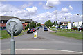
South end of Athena Drive, Tachbrook Park, Warwick/Leamington
Tachbrook Park has evolved into a mix of business, retail and leisure uses. It was a response to the approach of the M40 extension in the 1980s, filling in the urban fringe farmland between existing industrial estates south of Leamington. Developers on Tachbrook Park seem to have competed to put up the ugliest building. On the left, the offices of Bridgestone. Beyond it are two wings of Athena Court, a cluster of smaller office buildings. On the right is the rear of the Renault dealership and beyond it is Orion House, now occupied by part of the county council.
Image: © Robin Stott
Taken: 23 Jul 2009
0.03 miles
2
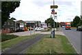
Collins Road, Heathcote Industrial Estate, Warwick/Leamington
A long-established estate that has niches for a cluster of support services: food outlets, office services, car wash…
Image: © Robin Stott
Taken: 23 Jul 2009
0.11 miles
3
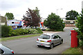
Collins Road, Heathcote Industrial Estate, Warwick/Leamington
The posting box is for franked mail, ID CV34 4.
Image: © Robin Stott
Taken: 23 Jul 2009
0.12 miles
4
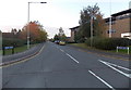
Athena Drive, Leamington Spa
Looking SSE from Apollo Way. Athena House http://www.geograph.org.uk/photo/4216573 is on the right.
Image: © Jaggery
Taken: 19 Oct 2014
0.12 miles
5
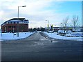
Artemis Drive, Leamington Spa
View west along Artemis Drive from its junction with Tachbrook Park Drive.
Image: © David P Howard
Taken: 24 Dec 2010
0.12 miles
6
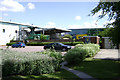
Grupo Antolin's works, Tachbrook Park Drive, Leamington
In the background is the west side of the western Wolseley building Image, another example of the new industrial and commercial developments that have sprung up on the sites of former industry south of Queensway and west of Tachbrook Road.
Image: © Robin Stott
Taken: 23 Jul 2009
0.15 miles
7
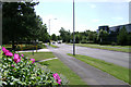
Tachbrook Park Drive, Leamington
The road becomes more leafy as it goes south. Tachbrook Park has evolved into a mix of business, retail and leisure uses. It was a response to the approach of the M40 extension in the 1980s, filling in the urban fringe farmland between existing older industrial estates south of Leamington. Parts of those have been redeveloped or await redevelopment.
Image: © Robin Stott
Taken: 23 Jul 2009
0.16 miles
8
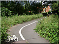
Cycleway, Heathcote, Warwick/Leamington
Although it looks lightly-used it provides a handy short link between the older Heathcote Industrial Estate and the newer Tachbrook Park. Here it crosses a miraculously surviving stream that gives its name to Brook Farm on its way to join the River Avon at Myton Image
Image: © Robin Stott
Taken: 23 Jul 2009
0.16 miles
9
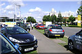
Peugeot dealership, Tachbrook Park Drive, Leamington
The showroom was undergoing a refit, hence this more-than-usually casual strewing of the stock over the surrounding area. This is one of several car dealerships on this road.
Image: © Robin Stott
Taken: 23 Jul 2009
0.16 miles
10

Leamington's other telephone exchange
The radio mast is a bit of a giveaway! This anonymous building in the industrial estates in south Leamington houses the cable TV company's telephone exchange serving subscibers in Leamington and the surrounding towns. BT's exchange for historical reasons is near the centre of the town.
Image: © David Stowell
Taken: 17 Mar 2009
0.16 miles