
IMAGES TAKEN NEAR TO
Foxes Way, WARWICK, CV34 6AY
Introduction
This page details the photographs taken nearby to Foxes Way, CV34 6AY by members of the Geograph project.
The Geograph project started in 2005 with the aim of publishing, organising and preserving representative images for every square kilometre of Great Britain, Ireland and the Isle of Man.

There are currently over 7.5m images from over14,400 individuals and you can help contribute to the project by visiting https://www.geograph.org.uk
Image Map
Images are licensed for reuse under creativecommons.org/licenses/by-sa/2.0
Notes
- Clicking on the map will re-center to the selected point.
- The higher the marker number, the further away the image location is from the centre of the postcode.
Image Listing (80 Images Found)
Images are licensed for reuse under creativecommons.org/licenses/by-sa/2.0
Image
Details
Distance
1
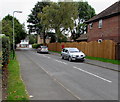
Alders Grove, Warwick
Viewed from the Stratford Road end looking towards Foxes Way.
Image: © Jaggery
Taken: 3 Oct 2015
0.03 miles
2
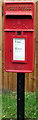
Queen Elizabeth II postbox, Alders Grove, Warwick
Located alongside the fence here. http://www.geograph.org.uk/photo/4684882
The name on the lower right corner of the box is
CARRON COMPANY STIRLINGSHIRE.
Image: © Jaggery
Taken: 3 Oct 2015
0.06 miles
4
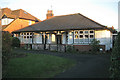
A bungalow called The Wickets, 97 Stratford Road
A classic form of dwelling and the odd one out among two-storey houses. According to old OS maps this southeast side of Stratford Road was developed almost completely between 1926 and 1938. Perhaps this was an early house on a single plot.
Image: © Robin Stott
Taken: 1 Dec 2012
0.07 miles
5
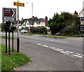
Turn right here for Warwick Racecourse
The sign on the corner of the A429 Stratford Road and Alders Grove points towards Shakespeare Avenue, http://www.geograph.org.uk/photo/4684875 the way to Newburgh Primary School and the racecourse.
Image: © Jaggery
Taken: 3 Oct 2015
0.07 miles
6

Residential road junction in Warwick
Junction of Shakespeare Road and Stratford Road
Image: © Clint Mann
Taken: 24 Feb 2016
0.08 miles
7
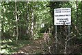
Access to woodland, Leyfields Crescent, Warwick
Well-worn paths form a circuit round and criss-cross a belt of degraded woodland on the western boundary of Warwick Castle Park. It appears to be part of Leafield Farm, hence the feeble attempts to prevent informal access. Other residential streets to the north are graced with heavy security fencing to prevent access to the pay-to-enter Castle grounds.
Image: © Robin Stott
Taken: 28 Aug 2009
0.08 miles
8
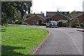
Leyfields Crescent, Warwick
One of several residential streets that look out to the boundary of Warwick Castle Park.
Image: © Robin Stott
Taken: 28 Aug 2009
0.08 miles
9
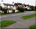
Stratford Road houses near Fishers Court, Warwick
The walker crossing Stratford Road approaches the Fishers Court junction.
Image: © Jaggery
Taken: 3 Oct 2015
0.09 miles
10
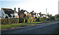
Detached and semi-detached houses, Stratford Road
This southeast side of Stratford Road was developed almost completely between 1926 and 1938, according to old OS maps.
Image: © Robin Stott
Taken: 1 Dec 2012
0.09 miles