
IMAGES TAKEN NEAR TO
Robin Hood Road, COVENTRY, CV3 3AL
Introduction
This page details the photographs taken nearby to Robin Hood Road, CV3 3AL by members of the Geograph project.
The Geograph project started in 2005 with the aim of publishing, organising and preserving representative images for every square kilometre of Great Britain, Ireland and the Isle of Man.

There are currently over 7.5m images from over14,400 individuals and you can help contribute to the project by visiting https://www.geograph.org.uk
Image Map
Images are licensed for reuse under creativecommons.org/licenses/by-sa/2.0
Notes
- Clicking on the map will re-center to the selected point.
- The higher the marker number, the further away the image location is from the centre of the postcode.
Image Listing (27 Images Found)
Images are licensed for reuse under creativecommons.org/licenses/by-sa/2.0
Image
Details
Distance
1
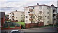
Blocks of flats on Robin Hood Road, Willenhall, Coventry
Viewed from Stretton Avenue.
Image: © A J Paxton
Taken: Unknown
0.01 miles
2
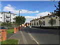
Northeast on Stretton Avenue, Willenhall, southeast Coventry
There's a great deal of local authority housing in Willenhall, much of it refurbished and trim.
Image: © Robin Stott
Taken: 5 Oct 2016
0.03 miles
3
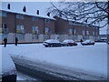
Stretton Avenue at junction with Robin Hood Road
Flats with maisonettes above, Stretton Avenue, Willenhall, Coventry, in the snow.
Image: © A J Paxton
Taken: 5 Feb 2009
0.03 miles
4
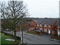
Newer housing on Stretton Avenue, Willenhall, Coventry
Stretton Avenue crosses the photo from left to bottom right. The newer houses in red brick cluster around Wolston Way, which opens onto Stretton Avenue in the middle left of the picture.
Image: © A J Paxton
Taken: 21 Mar 2010
0.03 miles
5
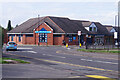
Robin Hood Road, Willenhall
Willenhall is based around a large council housing estate mainly built in the post Second World War period. Today it is among the 5% most deprived areas in England. Nevertheless, there is a strong community spirit here, embodied in the Betty Ennis Foundation, a charity named after a well-known community activist who died in 2019 that seeks to improve the lives of local people. The Betty Ennis Hub, part of Willenhall's shopping precinct, sells upcycled homeware items and home accessories as part of the charity's activities. The building has been used as a charity shop for some time but previously housed Willenhall Library (which moved to a different site nearby).
Image: © Stephen McKay
Taken: 25 Sep 2023
0.08 miles
6
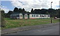
YMCA Willenhall, Stretton Avenue, southeast Coventry
The sign also says 'Part of YMCA Coventry and Warwickshire' https://ymca-cw.org.uk Another sign further along says 'Willenhall Older People's Office' with the logo of Coventry City Council (CCC) Social Services but no building to go with it. Maps of the 1950s show small dwellings here on previously open land – prefabs? In the 1980s and 1990s a building here is 'District Centre' and further along is another labelled 'Clinic'. However, behind the camera is a newer brick building identified as CCC Social Services, and in the village is the new facility seen in Image, so there's been a move around.
Image: © Robin Stott
Taken: 5 Oct 2016
0.08 miles
7
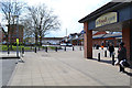
Neighbourhood centre, Willenhall, Coventry
Exploring the Sowe valley is hungry work. Having asked directions to the shops and having paid no attention to the map, I was astonished to find myself in Willenhall, a place I knew only by name. This photo is a record of that moment, which was accompanied by the certainty that I would return.
Image: © Robin Stott
Taken: 27 Apr 2016
0.08 miles
9
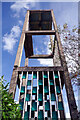
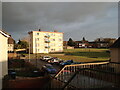
The Church of St John the Divine, Willenhall - tower
St John's church was designed by Basil Spence (who went on to design the new Coventry Cathedral) and built between 1954 and 1957 to serve a new housing estate. The tower of the grade II listed building is certainly distinctive but whether it is a thing of beauty is a matter of opinion.
Image: © Stephen McKay
Taken: 25 Sep 2023
0.10 miles
10
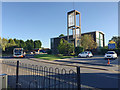
Church of St John the Divine, Robin Hood Road, Willenhall, southeast Coventry
Built in 1957 and designed by Basil Spence along with two other neighbourhood churches in Coventry. The rear of the church is seen in Image A number 60 bus heads for Arena Park in the north of the city. Photographed in the late afternoon of a bright day in early October.
Image: © Robin Stott
Taken: 5 Oct 2016
0.11 miles