
IMAGES TAKEN NEAR TO
Rugby Road, LEAMINGTON SPA, CV32 6EL
Introduction
This page details the photographs taken nearby to Rugby Road, CV32 6EL by members of the Geograph project.
The Geograph project started in 2005 with the aim of publishing, organising and preserving representative images for every square kilometre of Great Britain, Ireland and the Isle of Man.

There are currently over 7.5m images from over14,400 individuals and you can help contribute to the project by visiting https://www.geograph.org.uk
Image Map
Images are licensed for reuse under creativecommons.org/licenses/by-sa/2.0
Notes
- Clicking on the map will re-center to the selected point.
- The higher the marker number, the further away the image location is from the centre of the postcode.
Image Listing (274 Images Found)
Images are licensed for reuse under creativecommons.org/licenses/by-sa/2.0
Image
Details
Distance
1
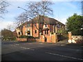
Offices of Blythe Liggins, solicitors, Leamington
The view is from Warwick New Road. The entrance to the building is in Rugby Road on the other side.
Image: © Robin Stott
Taken: 10 Jan 2014
0.01 miles
2
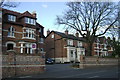
Warwick New Road, Leamington Spa
Several late Victorian villas have been converted to flats.
Their settings have been changed by paving over front gardens and widening openings in boundary walls.
Image: © Robin Stott
Taken: 29 Mar 2009
0.02 miles
3
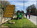
Rugby Road closures over Easter, Leamington
Closures will be in force while a railway bridge is being replaced. Although the near, eastbound, lane is closed, access to Quarry Street and Old Milverton Road is possible with care. Beyond Old Milverton Road, Rugby Road is closed in both directions on each side of the bridge Image The green item is a temporary street light. The width of the bridge on its transporter is such that everything in its path has to be removed – such as the lighting column. Solar panels must charge a battery that powers the light (telescopic, collapsed here).
Image: © Robin Stott
Taken: 10 Apr 2022
0.02 miles
4
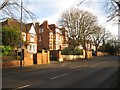
Substantial old houses, Warwick New Road, Leamington
Image: © Robin Stott
Taken: 10 Jan 2014
0.02 miles
5
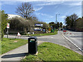
Junction of Rock Mill Lane and Rugby Road, Leamington
Rugby Road, right, is partially closed due to preparations for replacing a railway bridge ahead.
IMG_3717
Image: © Robin Stott
Taken: 10 Apr 2022
0.03 miles
6
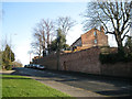
West end of Rugby Road
A closer look at the scene in Image emphasises the steepness of the slope and the massive retaining walls supporting private property. It rather looks as though this route developed after Emscote or Portobello Bridge was built across the Avon in the early 1820s, forming the "back road to Lillington" from Warwick shown on some maps. The parallel Warwick New Road and Warwick Place, laid out at the same time as the bridge, have much gentler gradients, easier for horse-drawn traffic.
Image: © Robin Stott
Taken: 15 Jan 2012
0.03 miles
7
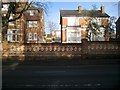
Polychrome brick boundary wall, Warwick New Road, Leamington
Image: © Robin Stott
Taken: 10 Jan 2014
0.03 miles
8
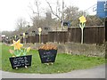
Signs outside a builder?s merchant, Rugby Road, Leamington
Spring fever at Jewson's! "Cheapest in town" for garden materials and – surprisingly – coal. Do people still burn coal?
Image: © Robin Stott
Taken: 19 Mar 2013
0.03 miles
9
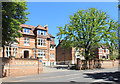
Victorian Housing, Warwick New Road
Image: © Des Blenkinsopp
Taken: 27 Jun 2018
0.04 miles
10
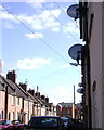
Quarry Street's communications, Leamington Spa
Image: © Robin Stott
Taken: 29 Mar 2009
0.05 miles