
IMAGES TAKEN NEAR TO
Hollis Road, COVENTRY, CV3 1AJ
Introduction
This page details the photographs taken nearby to Hollis Road, CV3 1AJ by members of the Geograph project.
The Geograph project started in 2005 with the aim of publishing, organising and preserving representative images for every square kilometre of Great Britain, Ireland and the Isle of Man.

There are currently over 7.5m images from over14,400 individuals and you can help contribute to the project by visiting https://www.geograph.org.uk
Image Map
Images are licensed for reuse under creativecommons.org/licenses/by-sa/2.0
Notes
- Clicking on the map will re-center to the selected point.
- The higher the marker number, the further away the image location is from the centre of the postcode.
Image Listing (33 Images Found)
Images are licensed for reuse under creativecommons.org/licenses/by-sa/2.0
Image
Details
Distance
1
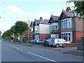
Houses on Stoke Green
The road is called Stoke Green but these 1930's semi-detached houses face onto the park with the same name.
Image: © Nigel Mykura
Taken: 11 Jun 2011
0.06 miles
2
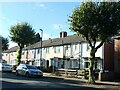
Student accommodation, Bolingbroke Road, Coventry
These houses were built in the early 1920s, in rows of four.
Image: © Christine Johnstone
Taken: 24 Sep 2021
0.07 miles
3

An evening in August, Stoke Green, Coventry CV3
Image: © Robin Stott
Taken: 9 Aug 2012
0.11 miles
4
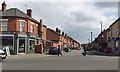
Bolingbroke Road, Lower Stoke, Coventry
On the 16A bus route. The view is east across Humber Road.
Image: © Robin Stott
Taken: 13 Apr 2019
0.12 miles
5
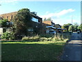
Housing on the west side of Aldermoor Lane, Coventry
A bit of late 1960s [?] infill at the southern end of Stoke Green.
Image: © Christine Johnstone
Taken: 24 Sep 2021
0.12 miles
6
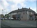
Coventry-Lower Stoke
Shops and houses on Humber Road.
Image: © Ian Rob
Taken: 14 Apr 2008
0.13 miles
7
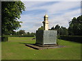
Stoke Green
This cast iron clock and drinking fountain seems to have been barricaded off after unwelcome attention!
Image: © David Stowell
Taken: 5 Aug 2005
0.13 miles
8
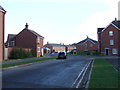
Anglian Way
Modern housing, East Stoke, Coventry.
Image: © JThomas
Taken: 19 Nov 2016
0.15 miles
9
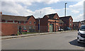
Bus stop and substation, Humber Road, Lower Stoke, Coventry
Stop for service 735 to Ansley Village via Corley.
Image: © Robin Stott
Taken: 13 Apr 2019
0.15 miles
10
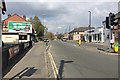
North end of Humber Road, Lower Stoke, Coventry
The open spaces ahead are Gosford Green on the left and Stoke Park on the right.
Image: © Robin Stott
Taken: 13 Apr 2019
0.16 miles