
IMAGES TAKEN NEAR TO
Brewster Close, COVENTRY, CV2 5NS
Introduction
This page details the photographs taken nearby to Brewster Close, CV2 5NS by members of the Geograph project.
The Geograph project started in 2005 with the aim of publishing, organising and preserving representative images for every square kilometre of Great Britain, Ireland and the Isle of Man.

There are currently over 7.5m images from over14,400 individuals and you can help contribute to the project by visiting https://www.geograph.org.uk
Image Map
Images are licensed for reuse under creativecommons.org/licenses/by-sa/2.0
Notes
- Clicking on the map will re-center to the selected point.
- The higher the marker number, the further away the image location is from the centre of the postcode.
Image Listing (11 Images Found)
Images are licensed for reuse under creativecommons.org/licenses/by-sa/2.0
Image
Details
Distance
1
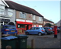
Binley Post Office
On Binley Road.
Showing position of Postbox No. CV3 95.
See Image] for postbox.
Image: © JThomas
Taken: 19 Nov 2016
0.15 miles
2
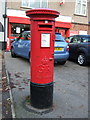
George V postbox, Binley Post Office
Postbox No. CV3 95.
See Image] for context.
Image: © JThomas
Taken: 19 Nov 2016
0.15 miles
3
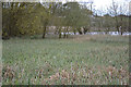
Sedges coming into flower at Stoke Floods, Stoke, southeast Coventry
It's probably Common Sedge, Carex nigra, but with this colouring it could be the common Glaucous or Carnation Sedge, Carex flacca. Stoke Floods is a local nature reserve. "The pool was formed when the Binley coal works caused the land to subside." (from Coventry City Council's Sowe Valley guide).
Image: © Robin Stott
Taken: 23 Apr 2016
0.17 miles
4
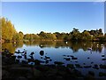
Return to Stoke Floods
An old geograph revisited: Image The water level seemed very low on this occasion, though. Stoke Floods is a flash, a body of water created by mining subsidence, in this case by Binley Colliery, which closed in 1963. The pool is a local nature reserve and an important site for water birds; see the site of the Warwickshire Wildlife Trust https://www.warwickshirewildlifetrust.org.uk/StokeFloods .
Image: © A J Paxton
Taken: 8 Oct 2022
0.17 miles
5
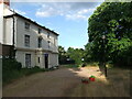
Stoke House, Wyken
Stoke House was built over 200 years ago and occupies a secluded site, surrounded by mature trees. It was the birthplace of Colonel William Fitzthomas Wyley, a chemist, who became the Lord Mayor of Coventry in 1911; he bought the Charterhouse, made it his home and bequeathed it to the city. After use by a barrage balloon unit during the Second World War, Stoke House became a children's home, and later offices for social/children's services. A modern secure unit for young people was built in the grounds and was demolished in 2013. Property guardians were living in the house at that time, and there was a planning application to convert it into a care home. Behind the house was a cobbled courtyard with a stable block. https://www.coventrysociety.org.uk/news/article/planning-permission-sought-for-conversion-of-stoke-house.html
Image: © A J Paxton
Taken: 24 Jul 2013
0.18 miles
6
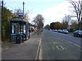
Bus stop and shelter on Binley Road (A428)
Looking east.
Image: © JThomas
Taken: 19 Nov 2016
0.18 miles
7
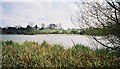
Stoke Floods looking towards Binley church and vicarage
Stoke Floods is a nature reserve comprising a pool surrounded by reedbeds and scrub. The pool is a flash, a body of water occupying land that has subsided, in this case as a result of mine-workings at Binley Colliery.
Image: © A J Paxton
Taken: Unknown
0.18 miles
9
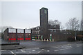
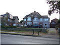
Binley fire station
Binley fire station, Hipswell Highway, Binley, Coventry, West Midlands
Image: © Kevin Hale
Taken: 25 Jan 2009
0.19 miles
10

Coventry-The Millpool
Public House on Hipswell Highway
Image: © Ian Rob
Taken: 24 Jun 2011
0.22 miles