
IMAGES TAKEN NEAR TO
Walsgrave Road, COVENTRY, CV2 4AG
Introduction
This page details the photographs taken nearby to Walsgrave Road, CV2 4AG by members of the Geograph project.
The Geograph project started in 2005 with the aim of publishing, organising and preserving representative images for every square kilometre of Great Britain, Ireland and the Isle of Man.

There are currently over 7.5m images from over14,400 individuals and you can help contribute to the project by visiting https://www.geograph.org.uk
Image Map
Images are licensed for reuse under creativecommons.org/licenses/by-sa/2.0
Notes
- Clicking on the map will re-center to the selected point.
- The higher the marker number, the further away the image location is from the centre of the postcode.
Image Listing (18 Images Found)
Images are licensed for reuse under creativecommons.org/licenses/by-sa/2.0
Image
Details
Distance
1
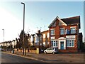
Dane Road meets Walsgrave Road, Stoke, Coventry
The houses of Dane Road are typical 1930s Motor City suburbia, but the building to the right, fronting onto Walsgrave Road, and with OFFICES carved over the door, is clearly older, late 19th or early 20th century, and is marked on the OS Six Inch Series map of that era. There are modern industrial premises behind it, which now have planning permission for redevelopment as retirement housing. The offices were, until the 1980s, those of Youell the builders, who constructed many of the suburban houses in this part of the city. Nearby stood a weighing house, long since demolished.
Image: © A J Paxton
Taken: 21 Jan 2023
0.01 miles
2
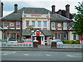
The Walsgrave
Large Pub and Carvery on the Corner of Walsgrave Road and Ansty Road
Image: © Kevin Croucher
Taken: 13 Jun 2005
0.04 miles
3
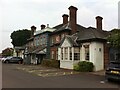
The Walsgrave Public House, corner of Walsgrave Road & Ansty Road, Wyken, Coventry
The Walsgrave is a roadside pub of the 1930s, in a very grand Queen Anne style, with a distinctive hipped roof with very tall chimneys. It is situated where the main road turns an abrupt corner, changing from Walsgrave Road, on which the pub officially stands, to Ansty Road.
Image: © A J Paxton
Taken: 24 Jul 2021
0.04 miles
4
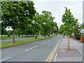
Ansty Road
Looking along Ansty Rd to the North East. M6 Junction 2 is about 2 1/2 miles away.
To the left is the playing field known locally as The Annexe
Image: © Kevin Croucher
Taken: 13 Jun 2005
0.04 miles
5

The Walsgrave in Coventry
A Crown Carveries public house and restaurant along the A4600 Walsgrave Road.
Image: © Mat Fascione
Taken: 11 Sep 2014
0.07 miles
6

Hebron Christian Faith Church, Walsgrave Road frontage, Stoke, Coventry
Eye-catching sight from a passing bus.
Image: © Robin Stott
Taken: 22 Sep 2013
0.20 miles
7
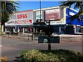
Run to the city of refuge
City of Refuge is a storefront church occupying part of a shopping centre in Stoke, Coventry; Lords Sofas is another occupant. They are viewed here from the palm-fringed oasis of a roundabout in the busy Walsgrave Road, which makes an abrupt ninety degree turn here.
For the spiritual or gospel song Run to the City of Refuge, see the Smithsonian Institute on Blind Willie Johnson https://folkways.si.edu/blind-willie-johnson/1927-1930/blues/music/album/smithsonian . The biblical cities of refuge occur in Numbers 35:6-34.
Image: © A J Paxton
Taken: 17 Sep 2022
0.20 miles
8
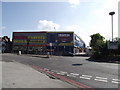
A change of use (2)
Hebron Penticostal church. Longfellow Road Coventry.
The previous use of this building was a bowling alley.
Image: © Anthony Vosper
Taken: 16 Apr 2011
0.21 miles
9
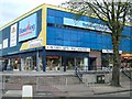
Forum Bowl and Shopping Centre
1960 Leisure and shopping centre
Image: © David Walton
Taken: 30 Jun 2006
0.21 miles
10
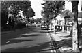
Church End
Looking up Burns Road to its junction with Walsgrave Road at Church End in Coventry.
Image: © Peter McDermott
Taken: Unknown
0.22 miles