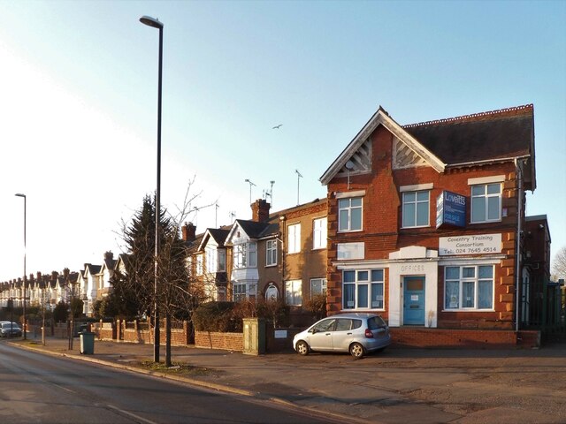
Dane Road meets Walsgrave Road, Stoke, Coventry
Introduction
The photograph on this page of Dane Road meets Walsgrave Road, Stoke, Coventry by A J Paxton as part of the Geograph project.
The Geograph project started in 2005 with the aim of publishing, organising and preserving representative images for every square kilometre of Great Britain, Ireland and the Isle of Man.
There are currently over 7.5m images from over 14,400 individuals and you can help contribute to the project by visiting https://www.geograph.org.uk

Image: © A J Paxton Taken: 21 Jan 2023
The houses of Dane Road are typical 1930s Motor City suburbia, but the building to the right, fronting onto Walsgrave Road, and with OFFICES carved over the door, is clearly older, late 19th or early 20th century, and is marked on the OS Six Inch Series map of that era. There are modern industrial premises behind it, which now have planning permission for redevelopment as retirement housing. The offices were, until the 1980s, those of Youell the builders, who constructed many of the suburban houses in this part of the city. Nearby stood a weighing house, long since demolished.

