
IMAGES TAKEN NEAR TO
Sewall Highway, COVENTRY, CV2 3NN
Introduction
This page details the photographs taken nearby to Sewall Highway, CV2 3NN by members of the Geograph project.
The Geograph project started in 2005 with the aim of publishing, organising and preserving representative images for every square kilometre of Great Britain, Ireland and the Isle of Man.

There are currently over 7.5m images from over14,400 individuals and you can help contribute to the project by visiting https://www.geograph.org.uk
Image Map
Images are licensed for reuse under creativecommons.org/licenses/by-sa/2.0
Notes
- Clicking on the map will re-center to the selected point.
- The higher the marker number, the further away the image location is from the centre of the postcode.
Image Listing (14 Images Found)
Images are licensed for reuse under creativecommons.org/licenses/by-sa/2.0
Image
Details
Distance
1
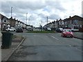
Roundabout on Sewall Highway
Looking south east.
Image: © JThomas
Taken: 4 Mar 2017
0.09 miles
2
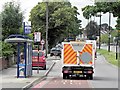
Bus Stop on Ansty Road
The bus stop at the corner of Hipswell Highway and Ansty Road.
Image: © David Dixon
Taken: 5 Aug 2013
0.16 miles
3
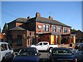
Coventry Oak Flaming Grill, Ansty Road/Hipswell Highway, Wyken, Coventry
Themed eaterie, seen from a bus.
Image: © Robin Stott
Taken: 22 Sep 2013
0.17 miles
4
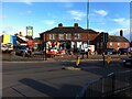
The New Pippin, Wyken, Coventry
This roadside pub, at the corner of Ansty Road and Hipswell Highway, opened in 1933 as the Wyken Pippin, and was known by that name for most of its subsequent history until 2010. Since 2018 it has been called the New Pippin. See the guide to pubs on Rob Orland's Historic Coventry site here https://www.historiccoventry.co.uk/cph/main/pub.php?pg=wyken_pippin .
The name Wyken Pippin referred to the apple variety grown locally in the 18th century. A young tree can be seen here Image and the fruit here Image
Image: © A J Paxton
Taken: 30 Oct 2021
0.17 miles
5
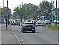
A4600 Ansty Road in Wyken
Heading towards Coventry city centre.
Image: © Mat Fascione
Taken: 11 Sep 2014
0.18 miles
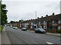
7
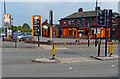
The Coventry Oak in Wyken, Coventry
A Flaming Grill public house along Ansty Road, on the corner with Hipswell Highway.
Image: © Mat Fascione
Taken: 11 Sep 2014
0.19 miles
8
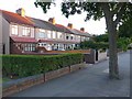
Terraced Houses in Wyken
These houses are on the south side of the Ansty Rd between Hocking Rd and the Hipswell Highway.
Image: © Nigel Mykura
Taken: 18 Aug 2010
0.20 miles
9
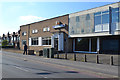
Wyken Working Men's Club, Ansty Road, Wyken, Coventry
It's affiliated to the CIU: the Working Men's Club and Institute Union. https://en.wikipedia.org/wiki/Working_Men%27s_Club_and_Institute_Union
Image: © Robin Stott
Taken: 1 Oct 2015
0.20 miles
10
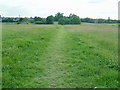
Wyken Croft Nature Park
This is the City's first ecological park. It was created by Coventry City Council as part of a Department of Environment reclamation scheme, and has involved top soiling to new contours, landscaping, planting native trees and wild flowers.It lies over what was once a coal mining area, Craven Colliery, and in the 1950's and 60s the site was used as a refuse tip.
Image: © Kevin Croucher
Taken: 13 Jun 2005
0.21 miles