
IMAGES TAKEN NEAR TO
The Thatchings, Rugby Road, RUGBY, CV22 6PB
Introduction
This page details the photographs taken nearby to The Thatchings, Rugby Road, CV22 6PB by members of the Geograph project.
The Geograph project started in 2005 with the aim of publishing, organising and preserving representative images for every square kilometre of Great Britain, Ireland and the Isle of Man.

There are currently over 7.5m images from over14,400 individuals and you can help contribute to the project by visiting https://www.geograph.org.uk
Image Map
Images are licensed for reuse under creativecommons.org/licenses/by-sa/2.0
Notes
- Clicking on the map will re-center to the selected point.
- The higher the marker number, the further away the image location is from the centre of the postcode.
Image Listing (167 Images Found)
Images are licensed for reuse under creativecommons.org/licenses/by-sa/2.0
Image
Details
Distance
1
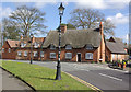
Rugby Road, Dunchurch
Traffic travelling through Dunchurch towards Rugby on the A426 passes a series of attractive buildings including Phoenix Cottage ahead.
Image: © Stephen McKay
Taken: 30 Mar 2008
0.01 miles
2
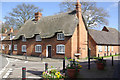
Phoenix Cottage, Dunchurch
Thatched cottage on the corner of Rugby Road and Vicarage Lane.
Image: © Stephen McKay
Taken: 30 Mar 2008
0.01 miles
3
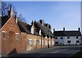
Dunchurch-Rugby Road
Cottages at the junction with Vicarage Lane.
Image: © Ian Rob
Taken: 14 Mar 2011
0.01 miles
4
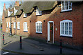
Phoenix Cottage, Dunchurch
Phoenix Cottage is the thatched building of Georgian origin on the corner of Rugby Road and Vicarage Lane.
Image: © Stephen McKay
Taken: 25 Dec 2020
0.01 miles
5
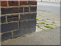
Nineteenth-century benchmark
This benchmark on the corner of 6 Rugby Road was established in 1848 during the First primary levelling of England & Wales, and was levelled with a height of 398.3080 feet [121.4043 metres] above mean sea level (Liverpool datum). It was included on the Birmingham to London (Branch Line from Dunchurch to Rugby) levelling line. The surveyor's description was "No. 1. Mark on corner of house, opposite the Crown Inn, Dunchurch ; 0.95 ft. above surface" (Public Abstract p.232). The height given on the Ordnance Survey database today is 121.1732m above mean sea level (Newlyn datum). The brick below, which would have been incised with an arrow, has been replaced.
Image: © Shantavira
Taken: 17 Apr 2015
0.02 miles
6
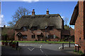
House at junction of Vicarage Lane and Rugby Road
Image: © Robert Eva
Taken: 21 Mar 2017
0.02 miles
7
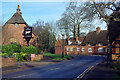
Rugby Road, Dunchurch
Being Christmas Day this road is quieter than usual, but even so it took a while to photograph the scene vehicle-free. On the left is the entrance to the Dun Cow car park, but sadly the old coaching inn had been closed for several weeks due to the Covid-19 pandemic. The building on the immediate right is the Old Forge and beyond that is Phoenix Cottage.
Image: © Stephen McKay
Taken: 25 Dec 2020
0.02 miles
8
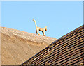
Thatch cat, Dunchurch
Thatched ridge detail on a cottage in Dunchurch. The cat makes a change from the usual thatch birds.
Image: © Andy F
Taken: 20 Apr 2009
0.02 miles
9
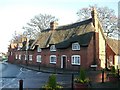
Dunchurch
Cottage on corner of Vicarage Lane and Rugby Road.
Image: © Ian Rob
Taken: 11 Jan 2006
0.02 miles
10
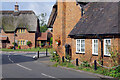
Vicarage Lane, Dunchurch
Just ahead is the junction of Vicarage Lane and Rugby Road in the most attractive part of the village.
Image: © Stephen McKay
Taken: 9 Sep 2022
0.02 miles