Nineteenth-century benchmark
Introduction
The photograph on this page of Nineteenth-century benchmark by Shantavira as part of the Geograph project.
The Geograph project started in 2005 with the aim of publishing, organising and preserving representative images for every square kilometre of Great Britain, Ireland and the Isle of Man.

There are currently over 7.5m images from over 14,400 individuals and you can help contribute to the project by visiting https://www.geograph.org.uk
Nineteenth-century benchmark
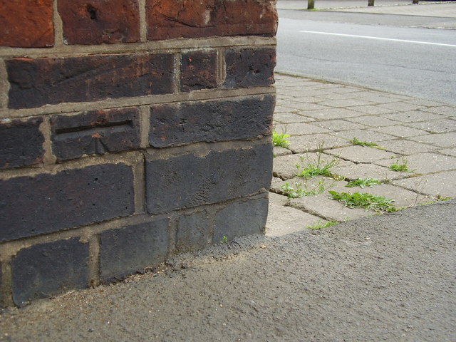
Image: © Shantavira Taken: 17 Apr 2015
This benchmark on the corner of 6 Rugby Road was established in 1848 during the First primary levelling of England & Wales, and was levelled with a height of 398.3080 feet [121.4043 metres] above mean sea level (Liverpool datum). It was included on the Birmingham to London (Branch Line from Dunchurch to Rugby) levelling line. The surveyor's description was "No. 1. Mark on corner of house, opposite the Crown Inn, Dunchurch ; 0.95 ft. above surface" (Public Abstract p.232). The height given on the Ordnance Survey database today is 121.1732m above mean sea level (Newlyn datum). The brick below, which would have been incised with an arrow, has been replaced.
Images are licensed for reuse under creativecommons.org/licenses/by-sa/2.0
Image Location
Latitude
52.337733
Longitude
-1.289007