
IMAGES TAKEN NEAR TO
Luscombe Road, COVENTRY, CV2 1AP
Introduction
This page details the photographs taken nearby to Luscombe Road, CV2 1AP by members of the Geograph project.
The Geograph project started in 2005 with the aim of publishing, organising and preserving representative images for every square kilometre of Great Britain, Ireland and the Isle of Man.

There are currently over 7.5m images from over14,400 individuals and you can help contribute to the project by visiting https://www.geograph.org.uk
Image Map
Images are licensed for reuse under creativecommons.org/licenses/by-sa/2.0
Notes
- Clicking on the map will re-center to the selected point.
- The higher the marker number, the further away the image location is from the centre of the postcode.
Image Listing (14 Images Found)
Images are licensed for reuse under creativecommons.org/licenses/by-sa/2.0
Image
Details
Distance
1
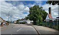
North on Broad Park Road, Coventry
The turning on the right is Logan Road. The chimney probably belongs to Broad Park House. A report from 2019 explains that the Centre there provides short breaks for young disabled children https://www.coventrytelegraph.net/news/coventry-news/short-breaks-disabled-children-set-17333222
Image: © Robin Stott
Taken: 8 Jun 2022
0.16 miles
2
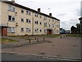
Henley Green Flats
Typicalof the surrounding area, on Widdecombe Close off Henley Road.
Image: © Ian Rob
Taken: 26 Jul 2013
0.18 miles
3
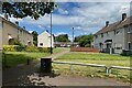
Chudleigh Road, Henley Green, Coventry
On this estate most of the roads are named after Devon towns and villages. Chudleigh Road is a named footpath.
Image: © Robin Stott
Taken: 8 Jun 2022
0.18 miles
4
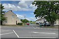
Luscombe Road, Henley Green, Coventry
On this estate most of the roads are named after Devon towns and villages. The view is across Henley Road.
Image: © Robin Stott
Taken: 8 Jun 2022
0.19 miles
5
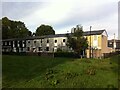
Woodway Walk, Henley Green
Houses on Woodway Walk can be seen from the green space of the Potters Green corridor. The Woodway Lane estate of council housing at Henley Green was built in 1962-4 by the Midlands Housing Consortium to designs by Fred Lloyd Roche, who had worked under Arthur Ling, the city architect of Coventry. For more information, see the Historic England e-publication Coventry: The making of a modern city 1939-73 by Jeremy Gould & Caroline Gould, pp93-96 https://historicengland.org.uk/images-books/publications/coventry-making-of-modern-city-1939-73/coventry-making-of-modern-city-1939-73/ .
The estate, like many in Coventry, was built on the Radburn system, named after the New Jersey town where it was pioneered in 1929. In this design, houses front onto traffic-free paths connected by greens, while garages are provided in cul-de-sac roads nearby. The Goulds comment that, "The houses drew consistent praise from the architectural press for their design and economy. The tenants criticised the poor soundproofing, lack of storage, tiny gardens and
inadequate heating but their children were happy playing on the roads leaving the traffic-free greens almost unused."
Image: © A J Paxton
Taken: 9 Oct 2022
0.19 miles
6
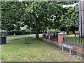
Henley Road, Henley Green, Coventry
Leafy Henley Road east of the junction with Broad Park Road. To the right is a block of 12 flats, Wyatt House.
Image: © Robin Stott
Taken: 8 Jun 2022
0.20 miles
7
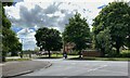
Broad Park Road meets Henley Road, Coventry
Across the road is Manor Farmhouse, a Grade II listed early 17th-century farmhouse https://historicengland.org.uk/listing/the-list/list-entry/1076611?section=official-list-entry OpenStreetMap shows it as Manor 'Farmyard' and garden but nothing about it can be found. It should not be confused with a restaurant in Earlsdon. Manor Farm gives its name to an entire housing estate in this area.
Image: © Robin Stott
Taken: 8 Jun 2022
0.21 miles
8

Manor Farmhouse, Henley Road, Coventry
It is a Grade II listed early 17th-century farmhouse https://historicengland.org.uk/listing/the-list/list-entry/1076611?section=official-list-entry It has given its name to an entire housing estate. It is clearly in use but its use is not known. Open Street Map shows it as Manor 'farmyard' and garden. Historic England shows it as Manor Farm Cottages.
Image: © Robin Stott
Taken: 8 Jun 2022
0.21 miles
9
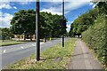
West on Henley Road, Coventry
On the left is the boundary to Manor Farmhouse Image The turning on the right is Broad Park Road Image
Image: © Robin Stott
Taken: 8 Jun 2022
0.21 miles
10
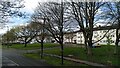
Flats on Widdecombe Close seen from Henley Road
These housing blocks form part of the Manor Farm estate, designed by Coventry City Architect Donald Gibson and his team: see Image
Image: © A J Paxton
Taken: 23 Mar 2024
0.23 miles