Manor Farmhouse, Henley Road, Coventry
Introduction
The photograph on this page of Manor Farmhouse, Henley Road, Coventry by Robin Stott as part of the Geograph project.
The Geograph project started in 2005 with the aim of publishing, organising and preserving representative images for every square kilometre of Great Britain, Ireland and the Isle of Man.

There are currently over 7.5m images from over 14,400 individuals and you can help contribute to the project by visiting https://www.geograph.org.uk
Manor Farmhouse, Henley Road, Coventry
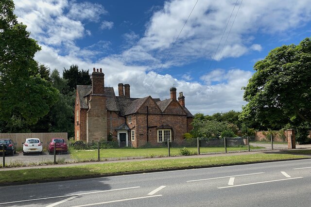
Image: © Robin Stott Taken: 8 Jun 2022
It is a Grade II listed early 17th-century farmhouse https://historicengland.org.uk/listing/the-list/list-entry/1076611?section=official-list-entry It has given its name to an entire housing estate. It is clearly in use but its use is not known. Open Street Map shows it as Manor 'farmyard' and garden. Historic England shows it as Manor Farm Cottages.
Images are licensed for reuse under creativecommons.org/licenses/by-sa/2.0
Image Location
Latitude
52.428889
Longitude
-1.457705