Woodway Walk, Henley Green
Introduction
The photograph on this page of Woodway Walk, Henley Green by A J Paxton as part of the Geograph project.
The Geograph project started in 2005 with the aim of publishing, organising and preserving representative images for every square kilometre of Great Britain, Ireland and the Isle of Man.

There are currently over 7.5m images from over 14,400 individuals and you can help contribute to the project by visiting https://www.geograph.org.uk
Woodway Walk, Henley Green
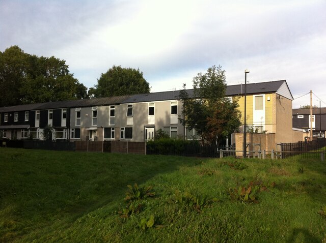
Image: © A J Paxton Taken: 9 Oct 2022
Houses on Woodway Walk can be seen from the green space of the Potters Green corridor. The Woodway Lane estate of council housing at Henley Green was built in 1962-4 by the Midlands Housing Consortium to designs by Fred Lloyd Roche, who had worked under Arthur Ling, the city architect of Coventry. For more information, see the Historic England e-publication Coventry: The making of a modern city 1939-73 by Jeremy Gould & Caroline Gould, pp93-96 https://historicengland.org.uk/images-books/publications/coventry-making-of-modern-city-1939-73/coventry-making-of-modern-city-1939-73/ . The estate, like many in Coventry, was built on the Radburn system, named after the New Jersey town where it was pioneered in 1929. In this design, houses front onto traffic-free paths connected by greens, while garages are provided in cul-de-sac roads nearby. The Goulds comment that, "The houses drew consistent praise from the architectural press for their design and economy. The tenants criticised the poor soundproofing, lack of storage, tiny gardens and inadequate heating but their children were happy playing on the roads leaving the traffic-free greens almost unused."
Images are licensed for reuse under creativecommons.org/licenses/by-sa/2.0
Image Location
Latitude
52.430746
Longitude
-1.451063