
IMAGES TAKEN NEAR TO
Chudleigh Road, COVENTRY, CV2 1AF
Introduction
This page details the photographs taken nearby to Chudleigh Road, CV2 1AF by members of the Geograph project.
The Geograph project started in 2005 with the aim of publishing, organising and preserving representative images for every square kilometre of Great Britain, Ireland and the Isle of Man.

There are currently over 7.5m images from over14,400 individuals and you can help contribute to the project by visiting https://www.geograph.org.uk
Image Map
Images are licensed for reuse under creativecommons.org/licenses/by-sa/2.0
Notes
- Clicking on the map will re-center to the selected point.
- The higher the marker number, the further away the image location is from the centre of the postcode.
Image Listing (26 Images Found)
Images are licensed for reuse under creativecommons.org/licenses/by-sa/2.0
Image
Details
Distance
1
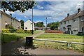
Chudleigh Road, Henley Green, Coventry
On this estate most of the roads are named after Devon towns and villages. Chudleigh Road is a named footpath.
Image: © Robin Stott
Taken: 8 Jun 2022
0.02 miles
2
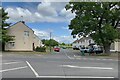
Luscombe Road, Henley Green, Coventry
On this estate most of the roads are named after Devon towns and villages. The view is across Henley Road.
Image: © Robin Stott
Taken: 8 Jun 2022
0.03 miles

4

East on Henley Road, Coventry
Here Henley Road is approaching the right turn into Henley Industrial Park. Lunchtime – the Costcutter, right, was doing a brisk trade.
Image: © Robin Stott
Taken: 8 Jun 2022
0.08 miles
5
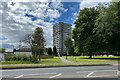
Sulgrave Close, Henley Green, Coventry
Sulgrave Close is the single-storey housing development on the left. The straight path signed Sulgrave Close leads to Caradoc Hall, a 17-storey block of flats. Is it in Henley Green or in Wyken to the south? Only Coventrians will know. The parked cars on the right are on Caradoc Close.
Image: © Robin Stott
Taken: 8 Jun 2022
0.09 miles

7
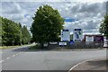
Entrance, Henley Industrial Park, Coventry
"Owned and managed by The Wigley Group Ltd". The entrance is at the bottom of the site plan. The space near the entrance is occupied by HGV trailers. The site extends south to open space along the north bank of the River Sowe Image Henley Road continues east, left.
Image: © Robin Stott
Taken: 8 Jun 2022
0.10 miles
8

Manor Farmhouse, Henley Road, Coventry
It is a Grade II listed early 17th-century farmhouse https://historicengland.org.uk/listing/the-list/list-entry/1076611?section=official-list-entry It has given its name to an entire housing estate. It is clearly in use but its use is not known. Open Street Map shows it as Manor 'farmyard' and garden. Historic England shows it as Manor Farm Cottages.
Image: © Robin Stott
Taken: 8 Jun 2022
0.11 miles
9

North in Henley Industrial Park, Coventry
Looking back towards the entrance on Henley Road. The landscaping goes its own way where it can.
Image: © Robin Stott
Taken: 8 Jun 2022
0.11 miles
10
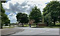
Broad Park Road meets Henley Road, Coventry
Across the road is Manor Farmhouse, a Grade II listed early 17th-century farmhouse https://historicengland.org.uk/listing/the-list/list-entry/1076611?section=official-list-entry OpenStreetMap shows it as Manor 'Farmyard' and garden but nothing about it can be found. It should not be confused with a restaurant in Earlsdon. Manor Farm gives its name to an entire housing estate in this area.
Image: © Robin Stott
Taken: 8 Jun 2022
0.12 miles