Sulgrave Close, Henley Green, Coventry
Introduction
The photograph on this page of Sulgrave Close, Henley Green, Coventry by Robin Stott as part of the Geograph project.
The Geograph project started in 2005 with the aim of publishing, organising and preserving representative images for every square kilometre of Great Britain, Ireland and the Isle of Man.

There are currently over 7.5m images from over 14,400 individuals and you can help contribute to the project by visiting https://www.geograph.org.uk
Sulgrave Close, Henley Green, Coventry
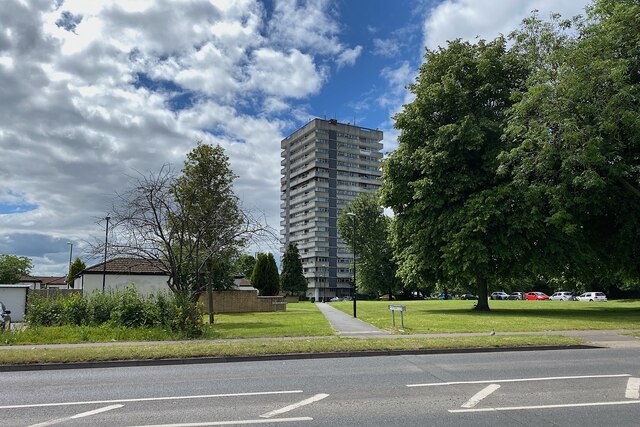
Image: © Robin Stott Taken: 8 Jun 2022
Sulgrave Close is the single-storey housing development on the left. The straight path signed Sulgrave Close leads to Caradoc Hall, a 17-storey block of flats. Is it in Henley Green or in Wyken to the south? Only Coventrians will know. The parked cars on the right are on Caradoc Close.
Images are licensed for reuse under creativecommons.org/licenses/by-sa/2.0
Image Location
Latitude
52.428255
Longitude
-1.45683