IMAGES TAKEN NEAR TO
Doyle Close, RUGBY, CV21 1RA
Introduction
This page details the photographs taken nearby to Doyle Close, CV21 1RA by members of the Geograph project.
The Geograph project started in 2005 with the aim of publishing, organising and preserving representative images for every square kilometre of Great Britain, Ireland and the Isle of Man.

There are currently over 7.5m images from over14,400 individuals and you can help contribute to the project by visiting https://www.geograph.org.uk
Image Map
Images are licensed for reuse under creativecommons.org/licenses/by-sa/2.0
Notes
- Clicking on the map will re-center to the selected point.
- The higher the marker number, the further away the image location is from the centre of the postcode.
Image Listing (105 Images Found)
Images are licensed for reuse under creativecommons.org/licenses/by-sa/2.0
Image
Details
Distance
1
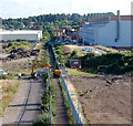
Looking north along the black path
This is the view north along the 'black path' from the footbridge over the west coast mainline railway west of Rugby station. The tracked excavator is crossing the path from one demolition site to another.
The 'black path' and footbridge connects the town centre to the substantial housing estates at Brownsover and was once the main pedestrian route from the town to the now-demolished engineering works.
For a view of the engineering works before demolition see [http://www.geograph.org.uk/photo/6771] .
For another view of the demolished site of the former engineering works see [http://www.geograph.org.uk/photo/861937] .
Image: © Andy F
Taken: 13 Jul 2009
0.04 miles
2
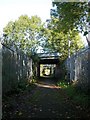
Rugby-Alstom Works
This footpath runs from the town centre to Brownsover. It crosses the railway then runs through the centre of the Alstom site. At this point two bridges link each half of the site.
Image: © Ian Rob
Taken: 20 Oct 2007
0.07 miles
3
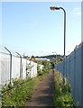
The black path
Looking north towards Brownsover along the black path.
The path connects the town centre to the substantial housing estates at Brownsover and was once the main pedestrian route from the town to the now-demolished engineering works.
Image: © Andy F
Taken: 13 Jul 2009
0.07 miles
4
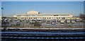
Ex-Works by the West Coast Main Line, Rugby
The building is the Rugby campus of Warwickshire College built on the site of the former engineering works, opened recently.
Image: © N Chadwick
Taken: 19 Dec 2010
0.09 miles
5
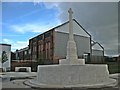
Rugby-Technology Drive
A new road linking Mill Road with Leicester Road has recently been opened.It runs across the old Alstom site.The war memorial for BTH workers has been cleaned up and moved from the original site entrance in Mill Road and placed in front of the few remaining buildings of the works.
Image: © Ian Rob
Taken: 11 Sep 2010
0.10 miles
6

Former Alstom site, Rugby
Seen from the railway footbridge, this large industrial site is in the first stages of a major redevelopment. Although Alstom still maintains a presence in Rugby, it is a shadow of what it was when the site was owned by, successively BTH, English Electric and GEC.
Image: © Stephen McKay
Taken: 18 Oct 2008
0.11 miles
7
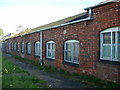
Rugby-Alstom Works
A row of single storey buildings running close to the footpath.
Image: © Ian Rob
Taken: 20 Oct 2007
0.12 miles
8
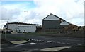
Rugby-Alstom Works
The last remaining workshops on the site stand at present alone in a scene of industrial dereliction.
Image: © Ian Rob
Taken: 11 Sep 2010
0.12 miles
9
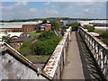
Alstom works
Alstom has several sites in Rugby, this is the biggest. Taken from the footbridge over the railway looking North.
Image: © David Reid
Taken: 2 May 2005
0.12 miles