
IMAGES TAKEN NEAR TO
Kirkistown Close, RUGBY, CV21 1AN
Introduction
This page details the photographs taken nearby to Kirkistown Close, CV21 1AN by members of the Geograph project.
The Geograph project started in 2005 with the aim of publishing, organising and preserving representative images for every square kilometre of Great Britain, Ireland and the Isle of Man.

There are currently over 7.5m images from over14,400 individuals and you can help contribute to the project by visiting https://www.geograph.org.uk
Image Map
Images are licensed for reuse under creativecommons.org/licenses/by-sa/2.0
Notes
- Clicking on the map will re-center to the selected point.
- The higher the marker number, the further away the image location is from the centre of the postcode.
Image Listing (86 Images Found)
Images are licensed for reuse under creativecommons.org/licenses/by-sa/2.0
Image
Details
Distance
1
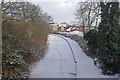
Oxford Canal, Brownsover
Seen here from the Leicester Road bridge, the canal has frozen solid and become covered with a layer of snow.
Image: © Stephen McKay
Taken: 9 Jan 2010
0.02 miles
2
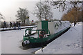
Oxford Canal, Brownsover
The canal has frozen solid and no boats will be moving for the time being. Note the group of teenagers on the opposite bank, some of whom are walking on the canal itself. The harsh winter of 1962/3 froze the canal network for several weeks and was one of the factors that finally killed off commercial carrying - today's pleasure boaters can afford to simply wait until their boats are movable again.
Image: © Stephen McKay
Taken: 9 Jan 2010
0.02 miles
3
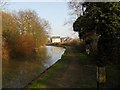
Rugby-Oxford Canal
Towpath east of Leicester Road bridge.
Image: © Ian Rob
Taken: 24 Mar 2012
0.03 miles
4
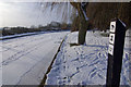
Oxford Canal, Brownsover
The British Waterways sign offers mooring here for a maximum of 24 hours; in fact, any boat moored here would be stuck until the canal thaws. Note the footprints on the ice - evidently thick enough to support the weight of a person, but probably not really an advisable thing to do.
Image: © Stephen McKay
Taken: 9 Jan 2010
0.03 miles
5
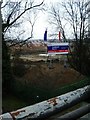
New Housing, Caldecott Manor, Brownsover
Sign overlooking site of new housing development near A426 Leicester Road.
Image: © Michael Westley
Taken: 18 Mar 2010
0.03 miles
6
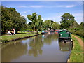
Brownsover Picnic Area
On the Oxford Canal.
Image: © Ian Rob
Taken: 30 Jul 2008
0.03 miles
7
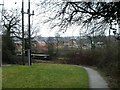
New Housing, Oxford canalside, Brownsover
View of housing being built on former factory area of Rugby, beside Oxford Canal, near Leicester Road.
Image: © Michael Westley
Taken: 18 Mar 2010
0.03 miles
8
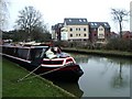
New Housing, Oxford Canalside, Brownsover
Near car park off Leicester Road on approach to Rugby.
Image: © Michael Westley
Taken: 18 Mar 2010
0.04 miles
9
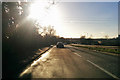
A426 Leicester Road, Rugby
Heading towards the town centre into a low winter sun.
Image: © Robin Webster
Taken: 7 Jan 2018
0.04 miles
10
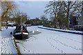
Oxford Canal, Brownsover
The canal is frozen solid on this cold but bright day.
Image: © Stephen McKay
Taken: 9 Jan 2010
0.04 miles