Oxford Canal, Brownsover
Introduction
The photograph on this page of Oxford Canal, Brownsover by Stephen McKay as part of the Geograph project.
The Geograph project started in 2005 with the aim of publishing, organising and preserving representative images for every square kilometre of Great Britain, Ireland and the Isle of Man.

There are currently over 7.5m images from over 14,400 individuals and you can help contribute to the project by visiting https://www.geograph.org.uk
Oxford Canal, Brownsover
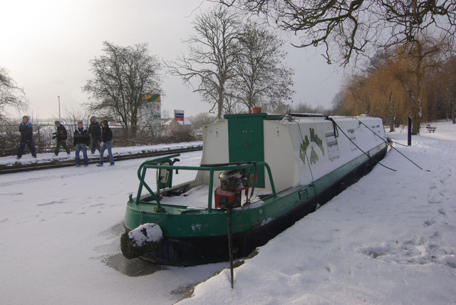
Image: © Stephen McKay Taken: 9 Jan 2010
The canal has frozen solid and no boats will be moving for the time being. Note the group of teenagers on the opposite bank, some of whom are walking on the canal itself. The harsh winter of 1962/3 froze the canal network for several weeks and was one of the factors that finally killed off commercial carrying - today's pleasure boaters can afford to simply wait until their boats are movable again.
Images are licensed for reuse under creativecommons.org/licenses/by-sa/2.0
Image Location
Latitude
52.389301
Longitude
-1.253941