1
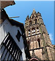
Coventry- Bayley Lane
A narrow Lane between the old cathedral and Saint Mary's Hall.
Image: © Ian Rob
Taken: 7 Dec 2007
0.01 miles
2
Castle Yard looking onto Hay Lane
Castle Yard is a courtyard surrounded by the Council House (the city hall of Coventry), St. Mary's Guildhall, and buildings on Hay Lane and Bayley Lane, some of them timber-framed structures, though now encased in brick. A passageway through one of these houses, seen here, leads into Hay Lane. The steeple of St. Michael's, the ruined cathedral, overlooks the yard, and in this picture a photo of it can be seen in a window on the other side of Hay Lane, framed by the passageway. There are two businesses facing onto Castle Yard, a bar and a tattoo parlour.
Image: © A J Paxton
Taken: 1 May 2021
0.01 miles
3
Hay Lane, Coventry
An old street near the Cathedral. Playwrights cafe bar/bistro on the right does excellent food.
Image: © Chris Allen
Taken: 26 Feb 2011
0.01 miles
4
County Hall, Cuckoo Lane
The red brick building on the left was the prison governer's house. The light stone building was the courtroom, designed by Samuel Eglinton and built 1783-84. Both buildings have been empty since the County Court moved to Much Park Street in 1989. The stonework on the courtroom underwent considerable renovation in 2000. The Victorian letter box on the side wall of the governer's house dates from the 1880s and has been out of use for several years but preserved as one of the oldest post boxes in Coventry.
County Hall is a grade II* listed building.
Image: © E Gammie
Taken: 13 Sep 2007
0.01 miles
5
Golden Cross Inn
The Golden Cross Inn, a late 16th century Grade II* listed inn. This is thought to be possibly the oldest inn in Coventry and in the past has been the Royal Exchange, the Dog and Duck and Cross Guns. There is a tradition that this was the site of the Coventry which was found in 1465 by Edward IV.
Image: © Philip Halling
Taken: 7 Aug 2019
0.01 miles
6
Golden Cross Inn, 8 Hay Lane, Coventry
Grade II* Listed inn on the site of the Coventry mint established by Edward IV in the 1460s minting gold and silver coins. The listing claims it to be built as an inn in 1583 and much restored it is reputed to be one of the longest serving alcohol establishments in England. The pub's website tells us it was built c.1583 and was first mentioned as an inn in 1661 making it Coventry's oldest pub. Following reconstruction work around the turn of the 20th century, it is largely unoriginal. An extension in 1968 substantially changed the interior of the pub, doubling the building's size by extending the gentleman's bar, smoke room and upstairs club room. It was most recently sympathetically refurbished in 2016-17. BBC local tells us the poet Philip Larkin (1922-1985) was a frequent visitor. A search of my limited Warwickshire directories produced; 1828-1830 Richard Farmer; 1835 Richard Ballard; 1842 Mary Ballard; 1850 J Phillips commercial inn; 1896 Arthur Bedford P.H.; 1912-1913 Henry Clarke Edwards; 1914 no publican given.
Image: © Jo and Steve Turner
Taken: 23 Feb 2023
0.01 miles
7
The ruined Cathedral Church of St. Michael
This church dates from 1300AD, it became the cathedral for the diocese of Coventry in 1918. The west tower and spire built 1374-1450, is 295 feet (90 metres) high. It survived the air raid of 14 November 1940, which destroyed the remainder of the church.
The house is 'The Cottage', at number 22 Bayley Lane, built in about 1500AD.
Image: © Mat Fascione
Taken: 18 Apr 2015
0.01 miles
8
Coventry-Pepper Lane
Looking towards Saint Michael's Tower.
Image: © Ian Rob
Taken: 5 Nov 2011
0.01 miles
9
Coventry-Pepper Lane
The complete view of Saint Michael's tower and spire from Pepper Lane.
Image: © Ian Rob
Taken: 5 Nov 2011
0.01 miles
10
Bayley Lane, Coventry
The city of Coventry suffered extensive bomb damage during the Second World War. Amongst the buildings destroyed was the cathedral, which was reduced to a shell. The corner of the cathedral ruin is visible straight ahead. Buildings across the street were luckier, surviving the bombing raid on Coventry.
Image: © Malc McDonald
Taken: 13 Jan 2013
0.01 miles


