
IMAGES TAKEN NEAR TO
Bond Street, COVENTRY, CV1 4FU
Introduction
This page details the photographs taken nearby to Bond Street, CV1 4FU by members of the Geograph project.
The Geograph project started in 2005 with the aim of publishing, organising and preserving representative images for every square kilometre of Great Britain, Ireland and the Isle of Man.

There are currently over 7.5m images from over14,400 individuals and you can help contribute to the project by visiting https://www.geograph.org.uk
Image Map
Images are licensed for reuse under creativecommons.org/licenses/by-sa/2.0
Notes
- Clicking on the map will re-center to the selected point.
- The higher the marker number, the further away the image location is from the centre of the postcode.
Image Listing (829 Images Found)
Images are licensed for reuse under creativecommons.org/licenses/by-sa/2.0
Image
Details
Distance
1
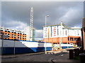
Bond Street
Construction equipment on site at the former Bond Street car park where a student accommodation block is about to be built.
Image: © E Gammie
Taken: 9 Feb 2016
0.00 miles
2
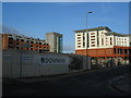
Bond Street
The two buildings visible are, to the left, Belgrade Plaza car park (formerly Leigh Mills) and, on the right a Premier Inn above ground floor restaurants. The site behind the hoardings is the former Bond Street car park, the proposed site for a multi-storey student accommodation development.
Image: © E Gammie
Taken: 23 Dec 2015
0.01 miles
3
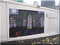
Belgrade Plaza hoarding
Work is currently under way redeveloping the area around the Belgrade Theatre. This decoration on one of the hoardings is the result of a collaboration with various nearby residents' groups. The background is a silhouette of the east windows of the old cathedral ruins. Above the hoarding the top of Hillman House tower block can be seen.
Image: © E Gammie
Taken: 19 Nov 2008
0.01 miles
4
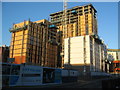
City Village, Bond Street
A multi-storey student accommodation development nearing completion, with and advertised opening date of September 2017.
December 2015: Image]
Image: © E Gammie
Taken: 5 Jan 2017
0.02 miles
5
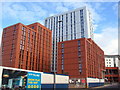
City Village, Bond Street
One of several student accommodation blocks to appear in the city centre in recent years, built 2016-17.
Jan 2017: Image]
Image: © E Gammie
Taken: 8 Oct 2017
0.02 miles
6
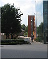
Towards Ryley Street
An area of stalled development. On the right, the completed Belgrade Plaza car park and, to the left of the trees, the still fenced off former Bond Street car park where nothing has happened for over four years. The building beyond the line of trees is the Friends Meeting House in Hill Street.
Image: © E Gammie
Taken: 7 Jul 2013
0.02 miles
7
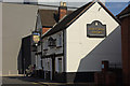
Town Wall Tavern, Coventry
Traditional pub on Bond Street somewhat overshadowed by the solid wall of the Belgrade Theatre.
Image: © Stephen McKay
Taken: 15 Sep 2012
0.03 miles
8
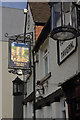
Town Wall Tavern, Coventry
The sign for this traditional pub on Bond Street is a reminder of Coventry's medieval past but is hardly representative of the modern city.
Image: © Stephen McKay
Taken: 15 Sep 2012
0.03 miles
9
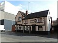
Town Wall Tavern, Bond Street, Coventry
The street was originally known as 'the Town Wall' hence the public house's name, which is probably of mid 19th century date (between 1835-51). Locally listed.
Image: © Alan Murray-Rust
Taken: 23 Sep 2021
0.03 miles
10
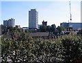
Former Bond Street car park, 2007
The former Bond Street car park is fenced off for the Belgrade Plaza redevelopment and remains so in 2014 (Image]). On the skyline are (L-R) Coventry Point in Market Way, Mercia House tower block, the crenellated tower of St John's church and an under-construction Ikea.
Image: © E Gammie
Taken: 25 Aug 2007
0.03 miles