
IMAGES TAKEN NEAR TO
St. Columbas Close, COVENTRY, CV1 4BX
Introduction
This page details the photographs taken nearby to St. Columbas Close, CV1 4BX by members of the Geograph project.
The Geograph project started in 2005 with the aim of publishing, organising and preserving representative images for every square kilometre of Great Britain, Ireland and the Isle of Man.

There are currently over 7.5m images from over14,400 individuals and you can help contribute to the project by visiting https://www.geograph.org.uk
Image Map
Images are licensed for reuse under creativecommons.org/licenses/by-sa/2.0
Notes
- Clicking on the map will re-center to the selected point.
- The higher the marker number, the further away the image location is from the centre of the postcode.
Image Listing (422 Images Found)
Images are licensed for reuse under creativecommons.org/licenses/by-sa/2.0
Image
Details
Distance
1

Barr's Hill Terrace
Part of the terrace of seven substantial mid-19th century houses standing in St Columba's Close[1].
Image: © E Gammie
Taken: 21 Oct 2009
0.00 miles
2
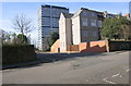
Junction in St Columba's Close
There is an OS benchmark Image on the corner of the wall at the left hand side of the junction
Image: © Roger Templeman
Taken: 12 Feb 2018
0.01 miles
3

Middleborough Terrace doorway detail
The lettering above the southern pair of two pairs of bricked-up doorways in the sandstone wall which is all that remains of Middleborough Terrace in St Columba's Close[1]. It reads "Middle:Borough Terrace 1851".
For further details see: Image]
The northern doorways: Image]
Image: © E Gammie
Taken: 21 Oct 2009
0.02 miles
4

Middleborough Terrace wall
This sandstone wall in St Columba's Close[1] has two arches with paired bricked-up doorways, one behind the second car from the right, the other behind the fifth car from the right. Each arch bears the inscription in gothic script "Middle:Borough Terrace 1851" in the area between the doorways (see Image and Image ).
The 1906 1:2500 Ordnance Survey (OS) of this area shows 2 pairs of what must have been very substantial semi-detached houses on the site, set well back from this wall. Directories of the area show that they were occupied up to 1939-40. A 1951 1:2500 OS shows the building outlines, but they are marked as 'ruins'. This area was close to factories targeted during WW2 and I assume they were either destroyed or severely damaged at that time. The multi-storey Samuel Vale House flats (the corner of which can be seen on the right) were built on the site in the 1960s.
The other side of the wall : http://www.geograph.org.uk/photo/2997044
Image: © E Gammie
Taken: 21 Oct 2009
0.02 miles
5

Middleborough Terrace doorways
The northern pair of two pairs of bricked-up doorways in the sandstone wall which is all that remains of Middleborough Terrace in St Columba's Close[1]. The lettering at the peak of the arch reads "Middle:Borough Terrace 1851".
For further details, see Image]
Image: © E Gammie
Taken: 21 Oct 2009
0.02 miles
6
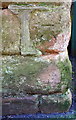
Benchmark on boundary wall of #27 St Columba's Close
Ordnance Survey cut mark benchmark described on the Bench Mark Database at http://www.bench-marks.org.uk/bm92983
Image: © Roger Templeman
Taken: 12 Feb 2018
0.02 miles
8
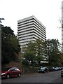
Samuel Vale House
A 1960s 17 storey block of flats standing between St Nicholas Street and St Columba's Close[1], viewed from St Columba's Close.
Image: © E Gammie
Taken: 21 Oct 2009
0.03 miles
9
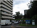
Tower blocks, Radford
The view from St Nicholas Street, on the other side of the Middleborough Terrace wall ( http://www.geograph.org.uk/photo/1570165 ). Sandwiched between Samuel Vale House, foreground and Naul's Mill House, right is Barrs Hill Terrace in St Columba's Close ( http://www.geograph.org.uk/photo/1570135 ).
Image: © E Gammie
Taken: 17 Jun 2012
0.03 miles
10
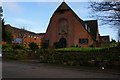
St Columba's United Reformed Church, Coventry
Image: © Ian S
Taken: 25 Dec 2013
0.03 miles