
IMAGES TAKEN NEAR TO
Queens Road, COVENTRY, CV1 3DG
Introduction
This page details the photographs taken nearby to Queens Road, CV1 3DG by members of the Geograph project.
The Geograph project started in 2005 with the aim of publishing, organising and preserving representative images for every square kilometre of Great Britain, Ireland and the Isle of Man.

There are currently over 7.5m images from over14,400 individuals and you can help contribute to the project by visiting https://www.geograph.org.uk
Image Map
Images are licensed for reuse under creativecommons.org/licenses/by-sa/2.0
Notes
- Clicking on the map will re-center to the selected point.
- The higher the marker number, the further away the image location is from the centre of the postcode.
Image Listing (618 Images Found)
Images are licensed for reuse under creativecommons.org/licenses/by-sa/2.0
Image
Details
Distance
1
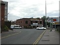
Coventry, night club
Careys, on the corner of Junction Street and Hertford Place. http://www.careys.co.uk/
Image: © Mike Faherty
Taken: 2 Jul 2010
0.03 miles
2
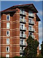
Apartment block
Apartment block overlooking Coventry's ringway around the city centre.
Image: © Philip Halling
Taken: 25 Sep 2021
0.04 miles
3
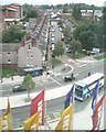
Starley Road, Coventry
One of the few streets of terraced houses inside the ring road, seen here across Croft Road from the southwest corner of Ikea on the level 5 landing.
Image: © Robin Stott
Taken: 10 Sep 2010
0.04 miles
4
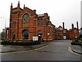
Coventry-Queens Road Baptist Church
Dating from 1884.
Image: © Ian Rob
Taken: 4 Jan 2014
0.05 miles
5
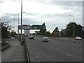
Coventry, Ring Road
As seen from Queens Road, looking towards Exit 7.
Image: © Mike Faherty
Taken: 2 Jul 2010
0.05 miles
6
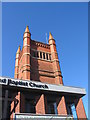
Tower of Queens Road Baptist Church
The height of this tower was reduced by about one third in the 1980s - a change in the brickwork can be seen above the slot openings.
Image: © E Gammie
Taken: 9 Mar 2017
0.05 miles
7
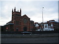
Queens Road Baptist Chapel
Viewed from the other side of the ring road. Designed by architects G and I Steane and built in the 1880s, with late 20th century additions. In the 1980s the total height of the tower was reduced by approximately one third.
The tower at its original height can be seen in the background of Image
Image: © E Gammie
Taken: 15 Dec 2010
0.06 miles
9
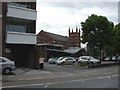
Coventry, Baptist church
Queens Road Baptist Church and Church Centre. http://www.qrbc.co.uk/
Image: © Mike Faherty
Taken: 2 Jul 2010
0.06 miles
10
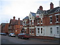
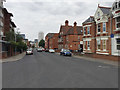
Southern end of Queen Victoria Road
Some of the remaining large semi-detached town houses in Queen Victoria Road, now used as offices. The now demolished northern end of the road was of a completely different nature, populated with basic red brick terraced houses.
Image: © E Gammie
Taken: 15 Dec 2010
0.07 miles