
IMAGES TAKEN NEAR TO
Parkside, COVENTRY, CV1 2NE
Introduction
This page details the photographs taken nearby to Parkside, CV1 2NE by members of the Geograph project.
The Geograph project started in 2005 with the aim of publishing, organising and preserving representative images for every square kilometre of Great Britain, Ireland and the Isle of Man.

There are currently over 7.5m images from over14,400 individuals and you can help contribute to the project by visiting https://www.geograph.org.uk
Image Map
Images are licensed for reuse under creativecommons.org/licenses/by-sa/2.0
Notes
- Clicking on the map will re-center to the selected point.
- The higher the marker number, the further away the image location is from the centre of the postcode.
Image Listing (402 Images Found)
Images are licensed for reuse under creativecommons.org/licenses/by-sa/2.0
Image
Details
Distance
2
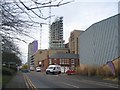
Building development in Parkside
Image: © E Gammie
Taken: 18 Dec 2019
0.04 miles
3
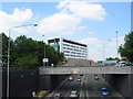
Ringway St Johns
The new office building on St John's Street looks quite striking from here. However, the traffic noise is appalling - I hope it's got good sound insulation. Taken from the footway across the centre of junction 5 roundabout, of which the bridge in the foreground is part.
Image: © E Gammie
Taken: 25 Jun 2010
0.04 miles
4
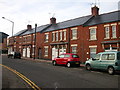
Coventry-Short Street
This terrace of houses is all there is to Short Street.
Image: © Ian Rob
Taken: 14 Nov 2007
0.05 miles
5
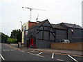
The former Admiral Lord Rodney public house
As can be seen from the gable end, this is a timber framed building and is thought to date from the 16th century although the arched window and doors in the frontage are from a much later date.
Image: © E Gammie
Taken: 23 Jun 2018
0.05 miles
6
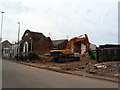
Demolition work in Parkside
The partially demolished remains of Parkside Spiritualist church.
Image: © E Gammie
Taken: 23 Jun 2018
0.05 miles
7
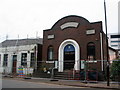
Demolition work in Parkside
The frontage of the partially demolished Parkside Spiritualist church.
Image: © E Gammie
Taken: 23 Jun 2018
0.05 miles
8
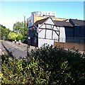
Glamorous Lord Rodney
This stretch of road was once part of Much Park Street, the main road out of Coventry towards London. The building of the ring road in the 1960s (just off to the left of this picture) cut it off from the rest of Much Park Street and the city centre, except for pedestrians, who could use an underpass. The orphaned road became part of Short Street, which ran at right angles to it, off to the right of this photo. Rob Orland's Historic Coventry site presents maps showing the area before and after the ring road https://www.historiccoventry.co.uk/covmaps/allmaps.php .
The pub in the centre of the picture is first mentioned in 1781, though the timber framing visible on the side wall suggests it is much older. For most of its life it was known as the Admiral Lord Rodney, after the naval commander George Brydges, who defeated the French at the Battle of the Saintes in the Caribbean in 1782. Since 1997 it has been a gay bar, known first as Rainbows and more recently as Glamorous. The Coventry's Pub History site (Rob Orland again, and friends) outlines its history and includes a photo from its Rodney days https://pubhistory.historiccoventry.co.uk/main/pub.php?pg=admiral_rodney
Image: © A J Paxton
Taken: 9 Jul 2022
0.06 miles
9
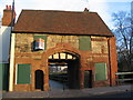
Whitefriar's gateway, Much Park Street
Currently empty and boarded up.
Image: © E Gammie
Taken: 10 Dec 2011
0.06 miles
10
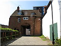
The Gatehouse to Whitefriars
This is now separated from the rest of the remains by the ring road.
Image: © Keith Williams
Taken: 21 Apr 2015
0.06 miles