Glamorous Lord Rodney
Introduction
The photograph on this page of Glamorous Lord Rodney by A J Paxton as part of the Geograph project.
The Geograph project started in 2005 with the aim of publishing, organising and preserving representative images for every square kilometre of Great Britain, Ireland and the Isle of Man.

There are currently over 7.5m images from over 14,400 individuals and you can help contribute to the project by visiting https://www.geograph.org.uk
Glamorous Lord Rodney
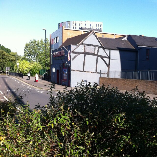
Image: © A J Paxton Taken: 9 Jul 2022
This stretch of road was once part of Much Park Street, the main road out of Coventry towards London. The building of the ring road in the 1960s (just off to the left of this picture) cut it off from the rest of Much Park Street and the city centre, except for pedestrians, who could use an underpass. The orphaned road became part of Short Street, which ran at right angles to it, off to the right of this photo. Rob Orland's Historic Coventry site presents maps showing the area before and after the ring road https://www.historiccoventry.co.uk/covmaps/allmaps.php . The pub in the centre of the picture is first mentioned in 1781, though the timber framing visible on the side wall suggests it is much older. For most of its life it was known as the Admiral Lord Rodney, after the naval commander George Brydges, who defeated the French at the Battle of the Saintes in the Caribbean in 1782. Since 1997 it has been a gay bar, known first as Rainbows and more recently as Glamorous. The Coventry's Pub History site (Rob Orland again, and friends) outlines its history and includes a photo from its Rodney days https://pubhistory.historiccoventry.co.uk/main/pub.php?pg=admiral_rodney
Images are licensed for reuse under creativecommons.org/licenses/by-sa/2.0
Image Location
Latitude
52.40419
Longitude
-1.504162