
IMAGES TAKEN NEAR TO
The Quadrant, COVENTRY, CV1 2EL
Introduction
This page details the photographs taken nearby to The Quadrant, CV1 2EL by members of the Geograph project.
The Geograph project started in 2005 with the aim of publishing, organising and preserving representative images for every square kilometre of Great Britain, Ireland and the Isle of Man.

There are currently over 7.5m images from over14,400 individuals and you can help contribute to the project by visiting https://www.geograph.org.uk
Image Map
Images are licensed for reuse under creativecommons.org/licenses/by-sa/2.0
Notes
- Clicking on the map will re-center to the selected point.
- The higher the marker number, the further away the image location is from the centre of the postcode.
Image Listing (1079 Images Found)
Images are licensed for reuse under creativecommons.org/licenses/by-sa/2.0
Image
Details
Distance
1
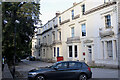
Along the Quadrant
A bit further south than Image, these are also grade II listed - https://historicengland.org.uk/listing/the-list/list-entry/1076595
A mix of uses, mostly offices. Number 6 is a sports clinic.
Image: © Bob Harvey
Taken: 5 Oct 2021
0.00 miles
2
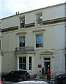
6 The Quadrant, Warwick Road, Coventry
The Quadrant dates from the middle of the 19th century, and unusually for a continuous terrace of the period, the houses are to different designs. The group is Listed Grade II, either singly or in combination. All the houses have been converted to office use.
Image: © Alan Murray-Rust
Taken: 23 Sep 2021
0.01 miles
3
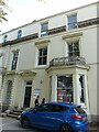
5 The Quadrant, Warwick Road, Coventry
The Quadrant dates from the middle of the 19th century, and unusually for a continuous terrace of the period, the houses are to different designs. The group is Listed Grade II, either singly or in combination. All the houses have been converted to office use.
Image: © Alan Murray-Rust
Taken: 23 Sep 2021
0.01 miles
4
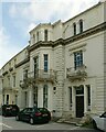
7 The Quadrant, Warwick Road, Coventry
The Quadrant dates from the middle of the 19th century, and unusually for a continuous terrace of the period, the houses are to different designs. The group is Listed Grade II, either singly or in combination. All the houses have been converted to office use.
Image: © Alan Murray-Rust
Taken: 23 Sep 2021
0.01 miles
5
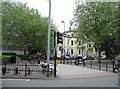
Cycle & Bike park - middle of Warwick Road
Image: © Mr Ignavy
Taken: 17 May 2008
0.01 miles
6
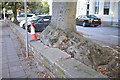
Spectacular root bole
This tree, from memory a Birch, has a prodigious root growth.
Image: © Bob Harvey
Taken: 5 Oct 2021
0.01 miles
7
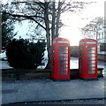
Telephone boxes at the Quadrant, Coventry
Image: © Robert Eva
Taken: 2 Jan 2017
0.02 miles
8
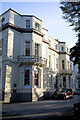
The start of The Quadrant
A 19th century terrace, called The Quadrant, all listed as a group as grade II. This end is listed here: https://historicengland.org.uk/listing/the-list/list-entry/1076594
Image: © Bob Harvey
Taken: 5 Oct 2021
0.02 miles
9
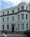
8 The Quadrant, Warwick Road, Coventry
The Quadrant dates from the middle of the 19th century, and unusually for a continuous terrace of the period, the houses are to different designs. The group is Listed Grade II, either singly or in combination. All the houses have been converted to office use.
Image: © Alan Murray-Rust
Taken: 23 Sep 2021
0.02 miles
10
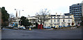
The Quadrant, Warwick Road
A mid 19th century curving terrace of stuccoed town houses of asymmetric style, completed by 1863. Although built on a curve, it does not actually form a quadrant. The complete terrace forms a group of grade II listed buildings. The pair of K6 telephone kiosks are also grade II listed.
In the background, left is Christchurch spire.
Image: © E Gammie
Taken: 15 Dec 2010
0.02 miles