The Quadrant, Warwick Road
Introduction
The photograph on this page of The Quadrant, Warwick Road by E Gammie as part of the Geograph project.
The Geograph project started in 2005 with the aim of publishing, organising and preserving representative images for every square kilometre of Great Britain, Ireland and the Isle of Man.

There are currently over 7.5m images from over 14,400 individuals and you can help contribute to the project by visiting https://www.geograph.org.uk
The Quadrant, Warwick Road
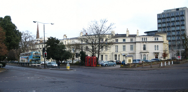
Image: © E Gammie Taken: 15 Dec 2010
A mid 19th century curving terrace of stuccoed town houses of asymmetric style, completed by 1863. Although built on a curve, it does not actually form a quadrant. The complete terrace forms a group of grade II listed buildings. The pair of K6 telephone kiosks are also grade II listed. In the background, left is Christchurch spire.
Images are licensed for reuse under creativecommons.org/licenses/by-sa/2.0
Image Location


Leaflet Map data © OpenStreetMap
Latitude
52.404586
Longitude
-1.512977