
IMAGES TAKEN NEAR TO
Milton Close, BEDWORTH, CV12 9HA
Introduction
This page details the photographs taken nearby to Milton Close, CV12 9HA by members of the Geograph project.
The Geograph project started in 2005 with the aim of publishing, organising and preserving representative images for every square kilometre of Great Britain, Ireland and the Isle of Man.

There are currently over 7.5m images from over14,400 individuals and you can help contribute to the project by visiting https://www.geograph.org.uk
Image Map
Images are licensed for reuse under creativecommons.org/licenses/by-sa/2.0
Notes
- Clicking on the map will re-center to the selected point.
- The higher the marker number, the further away the image location is from the centre of the postcode.
Image Listing (19 Images Found)
Images are licensed for reuse under creativecommons.org/licenses/by-sa/2.0
Image
Details
Distance
1
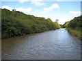
Coventry Canal: Bedworth Hill Cutting
A vast amount of soil and rock must have been excavated in the 1780s to create this straight cutting through Bedworth Hill. Both banks have been colonized by dense impenetrable thorn scrub making it a most inhospitable place. Centenary Way, celebrating 100 years of Warwickshire County Council, follows the towpath on the right here.
Image: © Nigel Cox
Taken: 11 Sep 2012
0.09 miles
2
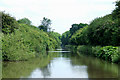
The Coventry Canal, Bedworth, Warwickshire
The Act of Parliament enabling the construction of the Coventry Canal was passed in 1768, and construction as far as Atherstone by 1771 was followed by the company running out of money and the sacking of James Brindley. One of the purposes of the canal was to provide Coventry with a regular supply of cheap coal from the Bedworth coalfield, which it already did by 1769.
The towpath here is used as part of The Centenary Way, a long distance walking path covering about 100 miles in Warwickshire.
Image: © Roger D Kidd
Taken: 10 Jun 2008
0.10 miles
4
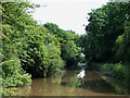
The Coventry Canal, Bedworth, Warwickshire
The Act of Parliament enabling the construction of the Coventry Canal was passed in 1768, and construction as far as Atherstone by 1771 was followed by the company running out of money and the sacking of James Brindley. One of the purposes of the canal was to provide Coventry with a regular supply of cheap coal from the Bedworth coalfield, which it already did by 1769.
The towpath here is used as part of The Centenary Way, a long distance walking path covering about 100 miles in Warwickshire.
Image: © Roger D Kidd
Taken: 10 Jun 2008
0.15 miles
5
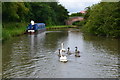
Swans on the Coventry Canal near Bedworth
Image: © David Martin
Taken: 17 Jul 2016
0.18 miles
7
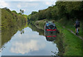
Coventry Canal on the edge of Bedworth
Image: © Mat Fascione
Taken: 28 Sep 2014
0.19 miles
8
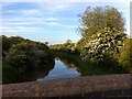
Coventry Canal looking northeast from Bridge no. 13, Coalpit Field (Bedworth Hill Bridge)
Here the course of the canal shifts from north to north east and it passes through a cutting overgrown with hawthorn and other trees. From the bridge, Coalpits Field Road leads north into the former mining town of Bedworth; to the east, the road becomes a farm track. The OS Six Inch 1888-1913 map shows a settlement here, Bedworth Hill, with two public houses, but little remains of it now. https://maps.nls.uk/geo/explore/side-by-side/#zoom=16&lat=52.47345&lon=-1.46547&layers=6&right=OSAPI
Image: © A J Paxton
Taken: 1 Jun 2021
0.21 miles
10
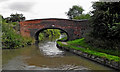
Bedworth Hill Bridge near Exhall, Bedworth, Warwickshire
Bedworth Hill Bridge is No 13 across the Coventry Canal.
Image: © Roger D Kidd
Taken: 20 Aug 2013
0.24 miles