
IMAGES TAKEN NEAR TO
Vanguard Place, CV12 0QL
Introduction
This page details the photographs taken nearby to Vanguard Place, CV12 0QL by members of the Geograph project.
The Geograph project started in 2005 with the aim of publishing, organising and preserving representative images for every square kilometre of Great Britain, Ireland and the Isle of Man.

There are currently over 7.5m images from over14,400 individuals and you can help contribute to the project by visiting https://www.geograph.org.uk
Image Map
Images are licensed for reuse under creativecommons.org/licenses/by-sa/2.0
Notes
- Clicking on the map will re-center to the selected point.
- The higher the marker number, the further away the image location is from the centre of the postcode.
Image Listing (17 Images Found)
Images are licensed for reuse under creativecommons.org/licenses/by-sa/2.0
Image
Details
Distance
1
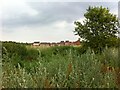
Housing to the east of the site of Newdigate Colliery
A view across what would have been fields to the east of Newdigate Colliery, which closed in 1982. The eastern part of the site has been redeveloped with housing, and there are proposals for more on the land in the foreground of the photo.
Image: © A J Paxton
Taken: 25 Jul 2021
0.04 miles
2
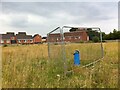
Mine monitoring, Market End, Bedworth
Monitoring device on land just to the east of the site of Newdigate Colliery, which closed in 1982. The houses look rather as if they are watching nervously from behind their fence to see what happens next. More housing is proposed for the field in the foreground.
Image: © A J Paxton
Taken: 25 Jul 2021
0.05 miles
3
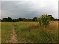
Site of Newdigate Colliery, looking towards Arbury Lane and modern housing beyond
Newdigate Colliery closed in 1982 and almost all traces of it have been removed. The photo shows the view from what would have been the south side of the main colliery buildings along the approach road from Astley Lane. More housing has been proposed for this site.
Image: © A J Paxton
Taken: 25 Jul 2021
0.05 miles
4
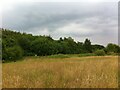
Site of Newdigate Colliery, Market End, Bedworth
Newdigate Colliery stood on this site and mined coal from 1901 to 1982. It took its name from the owners of the Arbury estate, which owns the land. The above-ground buildings of the colliery stood in the field on the right hand side of this picture, as can be seen in Ordnance Survey maps of the period. https://maps.nls.uk/geo/explore/side-by-side/#zoom=16&lat=52.48152&lon=-1.51019&layers=6&right=ESRIWorld
There is no trace of these buildings above ground today. The site is now a field with a linear wood running along the northern edge, which marks the northern side of the route of the mineral line which carried coal to the rail network and to the Coventry Canal. The woman and her dog visible in this photo are walking along a path that follows the line of the railway towards Bedworth. Parts of the site have been redeveloped with housing and the estate has proposed more in this area.
Image: © A J Paxton
Taken: 25 Jul 2021
0.10 miles
5
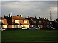
Housing at Marriott Road, Bedworth
These are 'Cornish' style houses - for further details of this type of house see the description on Image]
Image: © John Brightley
Taken: 11 Sep 2010
0.12 miles
7
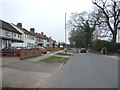
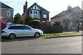
Smorrall Lane
Looking north west to the junction with Marriott Road.
Image: © JThomas
Taken: 11 Mar 2017
0.17 miles
10
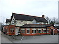
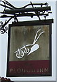
The Plough Inn, Bedworth
On Smorrall Lane.
Image: © JThomas
Taken: 11 Mar 2017
0.18 miles