IMAGES TAKEN NEAR TO
Smorrall Lane, BEDWORTH, CV12 0JP
Introduction
This page details the photographs taken nearby to Smorrall Lane, CV12 0JP by members of the Geograph project.
The Geograph project started in 2005 with the aim of publishing, organising and preserving representative images for every square kilometre of Great Britain, Ireland and the Isle of Man.

There are currently over 7.5m images from over14,400 individuals and you can help contribute to the project by visiting https://www.geograph.org.uk
Image Map
Images are licensed for reuse under creativecommons.org/licenses/by-sa/2.0
Notes
- Clicking on the map will re-center to the selected point.
- The higher the marker number, the further away the image location is from the centre of the postcode.
Image Listing (9 Images Found)
Images are licensed for reuse under creativecommons.org/licenses/by-sa/2.0
Image
Details
Distance
1
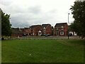
The 'burbs, Bluebell Drive, Bedworth
A gap in the trees on Bluebell Drive Park reveals brick-box Bedworth Heath in all its suburban glory.
Image: © A J Paxton
Taken: 19 Jun 2021
0.16 miles
2
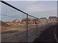
The Coventry Way footpath threads its way past what was then a construction site
Image: © Tim Glover
Taken: 22 Dec 2003
0.19 miles
4
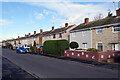
Keenan Drive, Bedworth Heath
Probably dating from around the early 1960s, these houses are typical of their era: very uniform and built in a dead straight line.
Image: © Stephen McKay
Taken: 18 Nov 2022
0.22 miles
5
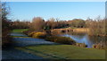
Bedworth Heath pond
This beautiful spot is an unusual find in the largely built up area of Bedworth and Bedworth Heath.
Image: © Peter Mackenzie
Taken: 29 Dec 2016
0.22 miles
6
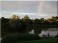
Fishermen and rainbow at lake near Smorrall Lane, Bedworth
The rear of houses in Silver Birch Avenue can be seen in the background.
This area has changed significantly in the last twenty years. Up until the early 1970's there was just farmland, crossed by the branch railway to Newdigate Colliery. This ran on the near side of the boundary hedge to the properties in Silver Birch Avenue, which were built in the 1970's and 80's. The land in the foreground of the photo contained some railway sidings. The lake was not created until about 2000 as part of the new housing development adjacent which was built c.2000-2005. Virtually all the landscaping seen in this photo has grown up within the last 10 years.
Image: © John Brightley
Taken: 11 Sep 2010
0.23 miles
8
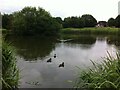
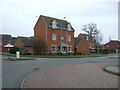
The Sidings Pool, Bluebell Drive Park, Bedworth
This pond is situated near the junction of Heath Road and Smorrall Lane, in the western suburbs of Bedworth. It is known locally as the Sidings Pool, and a glance at the OS Six Inch map, 1888-1913 Series, shows a siding here running off the mineral railway that connected the Newdigate Colliery on Astley Lane to the Coventry-Nuneaton railway line to the east. The colliery closed in 1982 and the tracks have long since been removed, but the route of the mineral railway can still be traced, especially where it passes through cuttings. https://maps.nls.uk/geo/explore/side-by-side/#zoom=16&lat=52.47762&lon=-1.50003&layers=6&right=OSAPI
Image: © A J Paxton
Taken: 19 Jun 2021
0.23 miles