
IMAGES TAKEN NEAR TO
Sorrell Place, NUNEATON, CV10 7AY
Introduction
This page details the photographs taken nearby to Sorrell Place, CV10 7AY by members of the Geograph project.
The Geograph project started in 2005 with the aim of publishing, organising and preserving representative images for every square kilometre of Great Britain, Ireland and the Isle of Man.

There are currently over 7.5m images from over14,400 individuals and you can help contribute to the project by visiting https://www.geograph.org.uk
Image Map
Images are licensed for reuse under creativecommons.org/licenses/by-sa/2.0
Notes
- Clicking on the map will re-center to the selected point.
- The higher the marker number, the further away the image location is from the centre of the postcode.
Image Listing (24 Images Found)
Images are licensed for reuse under creativecommons.org/licenses/by-sa/2.0
Image
Details
Distance
1
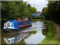
Narrowboat at Footbridge No 18a
On the Coventry Canal in the Hill Top area of Nuneaton.
Image: © Mat Fascione
Taken: 13 Sep 2015
0.01 miles
2
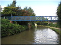
Coventry Canal: Bridge Number 18A
Bridge Number 18A is a modern footbridge that links Sorrell Road and Bradestone Road.
Image: © Nigel Cox
Taken: 11 Sep 2012
0.03 miles
3
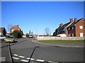
South end of Bradestone Road, Nuneaton
Looking north from the west end of Red Deeps.
Image: © Richard Vince
Taken: 2 Feb 2013
0.05 miles
4
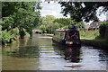
Coventry Canal, Hill Top
The narrowboat appears to be looking for a mooring as it passes through the southern outskirts of Nuneaton just beyond bridge 18A.
Image: © Stephen McKay
Taken: 29 Jul 2021
0.09 miles
5
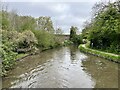
Coventry Canal
Near Bermuda, Warwickshire.
Image: © Andrew Abbott
Taken: 2 May 2023
0.12 miles
6
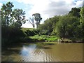
Coventry Canal: Abandoned Griff Arm
The reed beds and shallow cutting beyond mark the start of the long abandoned Griff Arm of the canal. Designed by Sir Roger Newdigate and opened in 1787 the cut was about 1,200 metres or about 1,300 yards long and terminated in a basin to the south of the village of Bermuda. Local coal, bricks and granite were transported out to the main canal along the arm. Some remnants of the canal, including most of the basin, still exist as water filled ponds on either side of the A444 road.
The wide section of the canal here is a formal winding hole enabling long narrow boats to be turned through 180 degrees.
Image: © Nigel Cox
Taken: 11 Sep 2012
0.17 miles
7
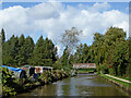
Coventry Canal south of Nuneaton in Warwickshire
This view of the Coventry Canal is near the Hill Top area of Nuneaton, looking north towards Donnithorne Avenue Bridge, No 18B.
Image: © Roger Kidd
Taken: 25 Sep 2016
0.18 miles
8
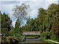
Coventry Canal approaching Nuneaton in Warwickshire
This view of the Coventry Canal is near the Hill Top area of Nuneaton, looking north towards Donnithorne Avenue Bridge, No 18B.
Image: © Roger Kidd
Taken: 25 Sep 2016
0.21 miles
9
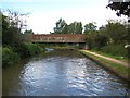
Coventry Canal: Bridge Number 18B
This bridge takes Donnithorne Avenue over the canal.
Image: © Nigel Cox
Taken: 11 Sep 2012
0.22 miles
10
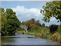
Coventry Canal north of Bedworth in Warwickshire
This is about three quarters of a mile north of Marston Junction (with the Ashby Canal).
Bridge No 18 is still called Turn Over Bridge*, but now is just an accommodation bridge with no public right of access on it or into adjacent farm land.
*A turnover bridge is one which allowed the horses to change sides on the canal without being unhitched from their boats. This used to happen here because an extra towpath on the left led onto the Griff Arm of the canal just beyond the bend ahead.
Image: © Roger D Kidd
Taken: 25 Sep 2016
0.22 miles