Coventry Canal: Abandoned Griff Arm
Introduction
The photograph on this page of Coventry Canal: Abandoned Griff Arm by Nigel Cox as part of the Geograph project.
The Geograph project started in 2005 with the aim of publishing, organising and preserving representative images for every square kilometre of Great Britain, Ireland and the Isle of Man.

There are currently over 7.5m images from over 14,400 individuals and you can help contribute to the project by visiting https://www.geograph.org.uk
Coventry Canal: Abandoned Griff Arm
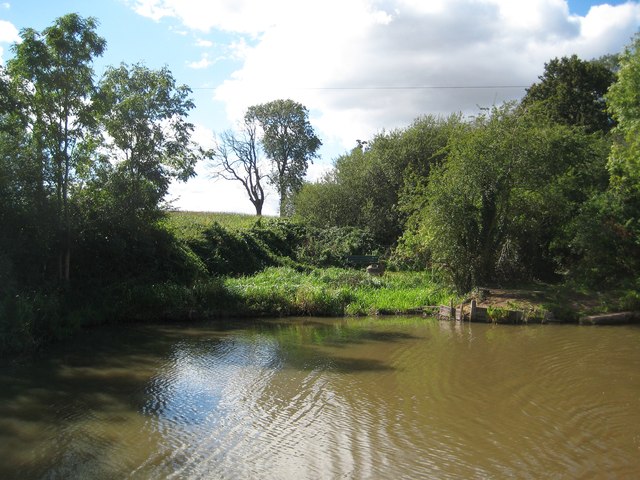
Image: © Nigel Cox Taken: 11 Sep 2012
The reed beds and shallow cutting beyond mark the start of the long abandoned Griff Arm of the canal. Designed by Sir Roger Newdigate and opened in 1787 the cut was about 1,200 metres or about 1,300 yards long and terminated in a basin to the south of the village of Bermuda. Local coal, bricks and granite were transported out to the main canal along the arm. Some remnants of the canal, including most of the basin, still exist as water filled ponds on either side of the A444 road. The wide section of the canal here is a formal winding hole enabling long narrow boats to be turned through 180 degrees.
Images are licensed for reuse under creativecommons.org/licenses/by-sa/2.0
Image Location
Latitude
52.502451
Longitude
-1.462988