
IMAGES TAKEN NEAR TO
Grange Close, NUNEATON, CV10 0JD
Introduction
This page details the photographs taken nearby to Grange Close, CV10 0JD by members of the Geograph project.
The Geograph project started in 2005 with the aim of publishing, organising and preserving representative images for every square kilometre of Great Britain, Ireland and the Isle of Man.

There are currently over 7.5m images from over14,400 individuals and you can help contribute to the project by visiting https://www.geograph.org.uk
Image Map
Images are licensed for reuse under creativecommons.org/licenses/by-sa/2.0
Notes
- Clicking on the map will re-center to the selected point.
- The higher the marker number, the further away the image location is from the centre of the postcode.
Image Listing (14 Images Found)
Images are licensed for reuse under creativecommons.org/licenses/by-sa/2.0
Image
Details
Distance
1
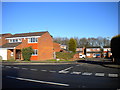
Grange Close, Chapel End
A small development of modern detached houses on the north side of Camp Hill Road at the eastern end of Chapel End.
Image: © Richard Vince
Taken: 2 Feb 2013
0.01 miles
2
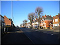
Camp Hill Road, Chapel End
Camp Hill Road is the main road through Chapel End, linking it with Nuneaton town centre.
Image: © Richard Vince
Taken: 2 Feb 2013
0.05 miles
3
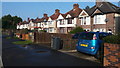
Housing in Camp Hill
The houses here are typical of the private housing stock in this suburb of Nuneaton.
Image: © Peter Mackenzie
Taken: 13 Feb 2017
0.06 miles
4
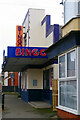
Grand Bingo and Social Club, Chapel End
Bingo was a hugely popular leisure activity in the second half of the 20th century, generally using converted cinemas that made ideal bingo halls. That has all changed now. Many bingo halls closed down around 2007, blaming the indoor smoking ban but that always seemed a lame excuse to cover for an industry that was fading anyway; bingo is now mostly an on-line activity and bingo halls have become as rare a sight as the suburban cinemas they superseded. This one was the last to survive in Nuneaton, finally succumbing to the inevitable in late 2021. The building itself was auctioned off in February 2022. It started life as the Grand Cinema in 1929 and was converted to a bingo hall in 1961, so it was a bingo hall for almost twice as long as it was a cinema.
Image: © Stephen McKay
Taken: 2 Nov 2022
0.14 miles
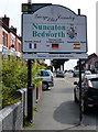
6
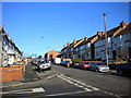
Near the top of Buck's Hill, Chapel End
Looking up Buck's Hill from its junction with Salisbury Drive (foreground).
Image: © Richard Vince
Taken: 2 Feb 2013
0.15 miles
7
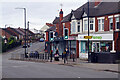
Camp Hill Road, Chapel End
Chapel End is a fairly drab area of Nuneaton although there are some useful shops here including the Lloyds pharmacy seen here. Victoria Road heads up the hill towards Hartshill.
Image: © Stephen McKay
Taken: 2 Nov 2022
0.16 miles
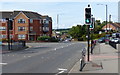
9
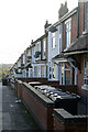
Bucks Hill, Chapel End
Looking down along a row of terraced houses from the top of Bucks Hill. Satellite dishes are much in evidence and the house in the foreground appears to have an extraordinary collection of wheely bins.
Image: © Stephen McKay
Taken: 9 Nov 2022
0.16 miles
10
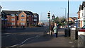
Chapel End
The B4114 is photographed at Chapel End, Nuneaton.
Image: © Peter Mackenzie
Taken: 13 Feb 2017
0.17 miles