
IMAGES TAKEN NEAR TO
Nash Court Gardens, MARGATE, CT9 4DE
Introduction
This page details the photographs taken nearby to Nash Court Gardens, CT9 4DE by members of the Geograph project.
The Geograph project started in 2005 with the aim of publishing, organising and preserving representative images for every square kilometre of Great Britain, Ireland and the Isle of Man.

There are currently over 7.5m images from over14,400 individuals and you can help contribute to the project by visiting https://www.geograph.org.uk
Image Map
Images are licensed for reuse under creativecommons.org/licenses/by-sa/2.0
Notes
- Clicking on the map will re-center to the selected point.
- The higher the marker number, the further away the image location is from the centre of the postcode.
Image Listing (36 Images Found)
Images are licensed for reuse under creativecommons.org/licenses/by-sa/2.0
Image
Details
Distance
1
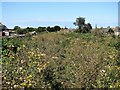
Abandoned railway track on outskirts of Margate
This was the track of the Ramsgate to Margate Sands railway closed in 1926. It became a closed-canopy linear wood until felled in February 2005, since when it has scrubbed over with a variety of plants. The white building in the distance is the Arlington House tower block built on or close to the terminus of the old railway line. The houses on the left are in Nash Road, those on the right in Nash Court Gardens.
Image: © Patrick Roper
Taken: 29 Aug 2007
0.02 miles
2
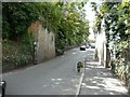
Abutments of former railway bridge over College Road
The bridge carried the Margate Sands Branch, which opened in 1846 and closed on 2 July 1926. The branch was a single line until 1863 and all trains had to reverse at Ramsgate. In 1863, the line was doubled and a triangular junction was completed at St Lawrence. The suffix “Sands” was added in 1889. Image was built on the site of Margate Sands station.
Image: © John Baker
Taken: 28 Jul 2013
0.03 miles

8
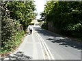
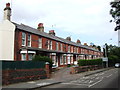
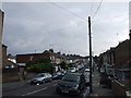
Tivoli Road
Almost opposite the man, an abutment of a former railway bridge is hidden in the shade. The bridge carried the Margate Sands Branch, which opened in 1846 and closed on 2 July 1926. The branch was a single line until 1863 and all trains had to reverse at Ramsgate. In 1863, the line was doubled and a triangular junction was completed at St Lawrence. The suffix “Sands” was added in 1889. Image was built on the site of Margate Sands station.
Image: © John Baker
Taken: 28 Jul 2013
0.10 miles
9
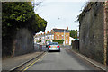
Former railway bridge over Tivoli Road, Margate
Just the abutments now, on the old SER line from Ramsgate to Margate Sands.
Image: © Robin Webster
Taken: 8 Feb 2018
0.10 miles
