Abandoned railway track on outskirts of Margate
Introduction
The photograph on this page of Abandoned railway track on outskirts of Margate by Patrick Roper as part of the Geograph project.
The Geograph project started in 2005 with the aim of publishing, organising and preserving representative images for every square kilometre of Great Britain, Ireland and the Isle of Man.

There are currently over 7.5m images from over 14,400 individuals and you can help contribute to the project by visiting https://www.geograph.org.uk
Abandoned railway track on outskirts of Margate
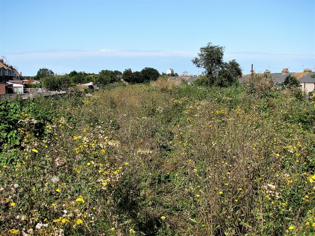
Image: © Patrick Roper Taken: 29 Aug 2007
This was the track of the Ramsgate to Margate Sands railway closed in 1926. It became a closed-canopy linear wood until felled in February 2005, since when it has scrubbed over with a variety of plants. The white building in the distance is the Arlington House tower block built on or close to the terminus of the old railway line. The houses on the left are in Nash Road, those on the right in Nash Court Gardens.
Images are licensed for reuse under creativecommons.org/licenses/by-sa/2.0
Image Location
Latitude
51.377704
Longitude
1.380922