IMAGES TAKEN NEAR TO
Crossways Business Park, BIRCHINGTON, CT7 0AA
Introduction
This page details the photographs taken nearby to Crossways Business Park, CT7 0AA by members of the Geograph project.
The Geograph project started in 2005 with the aim of publishing, organising and preserving representative images for every square kilometre of Great Britain, Ireland and the Isle of Man.

There are currently over 7.5m images from over14,400 individuals and you can help contribute to the project by visiting https://www.geograph.org.uk
Image Map
Images are licensed for reuse under creativecommons.org/licenses/by-sa/2.0
Notes
- Clicking on the map will re-center to the selected point.
- The higher the marker number, the further away the image location is from the centre of the postcode.
Image Listing (19 Images Found)
Images are licensed for reuse under creativecommons.org/licenses/by-sa/2.0
Image
Details
Distance
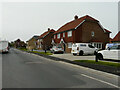
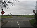
2

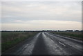
Junction of The Length with A28 Canterbury Road
Image: © Nick Smith
Taken: 3 Mar 2007
0.04 miles
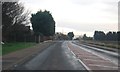
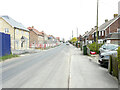
4
The Length
A similar view of Image from the west-south-west; the development has been named The Stables.
Image: © John Baker
Taken: 30 Apr 2023
0.08 miles
5
The Length
A similar view of Image from the west-south-west; the development has been named The Stables. At far end of the road is the tower of St Nicholas 'church.
Image: © John Baker
Taken: 30 Apr 2023
0.13 miles
6
Building site, The Length
Planning permission has been granted by Thanet District Council under application number F/TH/19/1231 for the “erection of 34 dwellings, together with associated landscaping, parking and access”.
The development has been named The Stables.
Image: © John Baker
Taken: 2 May 2022
0.14 miles
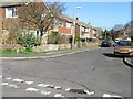
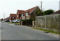
8
Sandalwood Drive
Semi detached house, from junction with Manor Road.
Image: © Oast House Archive
Taken: 24 Jun 2010
0.15 miles
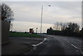
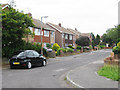
9
Viking Coastal Trail crosses the A28 Canterbury Road
The long distance cycle trail leads from St. Nicholas at Wade (via Manor Road) and then down to Monkton (via Orchard Lane).
Image: © David Anstiss
Taken: 6 Feb 2011
0.15 miles