IMAGES TAKEN NEAR TO
Chequer Tree Close, CANTERBURY, CT3 4BU
Introduction
This page details the photographs taken nearby to Chequer Tree Close, CT3 4BU by members of the Geograph project.
The Geograph project started in 2005 with the aim of publishing, organising and preserving representative images for every square kilometre of Great Britain, Ireland and the Isle of Man.

There are currently over 7.5m images from over14,400 individuals and you can help contribute to the project by visiting https://www.geograph.org.uk
Image Map
Images are licensed for reuse under creativecommons.org/licenses/by-sa/2.0
Notes
- Clicking on the map will re-center to the selected point.
- The higher the marker number, the further away the image location is from the centre of the postcode.
Image Listing (47 Images Found)
Images are licensed for reuse under creativecommons.org/licenses/by-sa/2.0
Image
Details
Distance
1
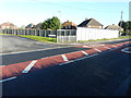
Hoarding, Island Road (A28)
Planning permission has been granted by Canterbury City Council under application number CA//14/01386 for a “proposed residential development consisting of 10 one bed flats, together with access and parking”. The location was described as land between The Sycamores and Chequer Tree Close, Island Road. The road sign, for Chequer Tree Close, can be seen to the left of the hoarding.
Image: © John Baker
Taken: 25 Jan 2016
0.03 miles
2
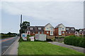
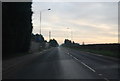
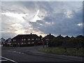
New housing development on the edge of Hersden
Hersden is almost entirely residential with regular buses into Canterbury along the A28, which is on the left side of this view.
Image: © Bill Boaden
Taken: 28 Jun 2012
0.04 miles
4
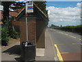
Bus Shelter on the A28
On Island Road, near Larch Close.
Image: © David Anstiss
Taken: 11 Jul 2010
0.04 miles
5
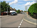
View along The Sycamores towards Island Road
Image: © Nick Smith
Taken: 7 Jul 2007
0.04 miles
6
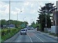
A28, Island Road, Hersden
Between Sarre and Canterbury, the A28 follows the line of an early Roman road.
Image: © David Dixon
Taken: 16 May 2013
0.04 miles
8
The Sycamores, Hersden
Most of Hersden is housing estates on the north of the A28. This is one of the access roads. Several streets locally are named after trees.
Image: © Bill Boaden
Taken: 28 Jun 2012
0.05 miles
9
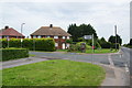
Island Road at the junction with The Sycamores
Image: © David Howard
Taken: 31 Jul 2016
0.06 miles
10
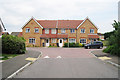
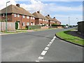
Houses on The Avenue
A terrace of three houses at junction with Larch Close (to right).
Image: © Oast House Archive
Taken: 24 Jun 2010
0.07 miles