IMAGES TAKEN NEAR TO
Station Road, HYTHE, CT21 5PW
Introduction
This page details the photographs taken nearby to Station Road, CT21 5PW by members of the Geograph project.
The Geograph project started in 2005 with the aim of publishing, organising and preserving representative images for every square kilometre of Great Britain, Ireland and the Isle of Man.

There are currently over 7.5m images from over14,400 individuals and you can help contribute to the project by visiting https://www.geograph.org.uk
Image Map
Images are licensed for reuse under creativecommons.org/licenses/by-sa/2.0
Notes
- Clicking on the map will re-center to the selected point.
- The higher the marker number, the further away the image location is from the centre of the postcode.
Image Listing (69 Images Found)
Images are licensed for reuse under creativecommons.org/licenses/by-sa/2.0
Image
Details
Distance
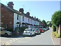
1
Elham Valley Way on Station Road
The long distance path leads up from Hythe towards the Sene Valley.
Image: © David Anstiss
Taken: 13 Nov 2010
0.01 miles
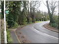
2
Mill Lane
An alley way off Station Road.
Image: © Oast House Archive
Taken: 24 Jul 2010
0.04 miles
3
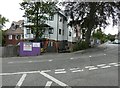
Briarwood, 1, Blackhouse Hill
The “for sale” and “sold” boards indicate that the estate agents are C R Child and Partners http://www.crchildandpartners.co.uk/
I noticed on the website that the building has retained its original name, which was mentioned in the planning application relating to Image
Image: © John Baker
Taken: 7 Feb 2016
0.08 miles
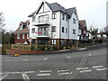
4
Erection of new dwellings, 1, Blackhouse Hill
Planning permission has been approved, with conditions, by Folkestone and Hythe District Council under application number Y13/0169/SH for the “erection of a part 3/part 2 storey block with rooms in the roof comprising of 2 apartments, a maisonette and 4 dwelling houses with associated parking facilities following demolition of existing building”. The existing building was known as Briarwood.
Image: © John Baker
Taken: 26 Jul 2015
0.08 miles
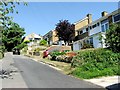
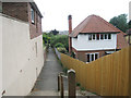
7
2A & 2B, Tanner?s Hill
Compared with Image, another house has been built. Two small plaques, affixed to the wooden boarding, indicate that 2A is Magnolia House and 2B is Crow’s Nest (I suppose this name refers to the further house).
Image: © John Baker
Taken: 8 Nov 2015
0.09 miles
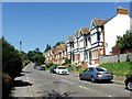
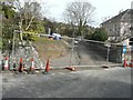
8
Erection of a house, Tanner?s Hill
Compared with Image, the house appears half built.
Image: © John Baker
Taken: 16 Dec 2014
0.10 miles
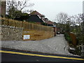
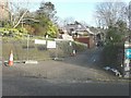
9
Entrance to building site at 2 Tanner?s Hill
Planning permission has been approved, with conditions, by Folkestone and Hythe District Council under application number Y11/0159/SH for the “erection of two detached three storey dwellings with upper floor set within roof space, integral garages to each house and formation of a new access to Tanner’s Hill, following demolition of existing dwelling at 5 Station Road”.
The site is now occupied by Image
Image: © John Baker
Taken: 2 Mar 2014
0.10 miles