IMAGES TAKEN NEAR TO
Old Hawkinge, FOLKESTONE, CT18 7RG
Introduction
This page details the photographs taken nearby to CT18 7RG by members of the Geograph project.
The Geograph project started in 2005 with the aim of publishing, organising and preserving representative images for every square kilometre of Great Britain, Ireland and the Isle of Man.

There are currently over 7.5m images from over14,400 individuals and you can help contribute to the project by visiting https://www.geograph.org.uk
Image Map
Images are licensed for reuse under creativecommons.org/licenses/by-sa/2.0
Notes
- Clicking on the map will re-center to the selected point.
- The higher the marker number, the further away the image location is from the centre of the postcode.
Image Listing (16 Images Found)
Images are licensed for reuse under creativecommons.org/licenses/by-sa/2.0
Image
Details
Distance
1
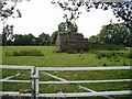
Flegis Court
Situated in what is locally known as Old Hawkinge, the house is a grade II listed building dating from the 18th and 19th centuries http://www.britishlistedbuildings.co.uk/en-441363-flegis-court-hawkinge-kent
Image: © John Baker
Taken: 15 Feb 2015
0.05 miles
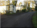
2
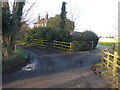
Hawkinge Hall
Situated in what is locally known as Old Hawkinge, the house is a grade II listed building dating from the late 18th or early 19th centuries http://www.britishlistedbuildings.co.uk/en-441364-hawkinge-hall-hawkinge-kent At one time, a smock mill stood beside Hawkinge Hall and its location was first shown on the 1819 ordnance survey map. It was built on a tall brick base in about 1800 but ceased working in 1902. It was demolished in the late 1960s.
Image: © John Baker
Taken: 15 Feb 2015
0.05 miles
3
Hawkinge Hall
Situated in what is locally known as Old Hawkinge, the house is a grade II listed building dating from the late 18th or early 19th centuries http://www.britishlistedbuildings.co.uk/en-441364-hawkinge-hall-hawkinge-kent At one time, a smock mill stood beside Hawkinge Hall and its location was first shown on the 1819 ordnance survey map. It was built on a tall brick base in about 1800 but ceased working in 1902. It was demolished in the late 1960s.
Image: © John Baker
Taken: 15 Feb 2015
0.05 miles
4
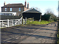
Small farm building in field at Old Hawkinge
Image: © Nick Smith
Taken: 28 Jun 2008
0.05 miles
5
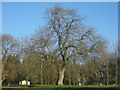
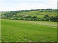
Oak Tree in field in Old Hawkinge
As seen from a lane to Hawkinge Hall Farm.
Image: © David Anstiss
Taken: 27 Feb 2011
0.06 miles
6
Firs Farm
Situated in what is locally known as Old Hawkinge and formerly known as Hawkinge Farm, the house is a grade II listed building dating from the early 19th century
http://www.britishlistedbuildings.co.uk/en-441221-firs-farm-hawkinge-kent
Image: © John Baker
Taken: 15 Feb 2015
0.10 miles
7
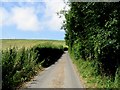
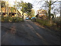
Looking N along Church Hill towards Old Hawkinge
Image: © Nick Smith
Taken: 28 Jun 2008
0.15 miles
8
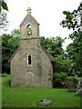
The church of St Michael the Archangel
Now converted to private house
Image: © Nick Smith
Taken: 13 Jun 2009
0.18 miles
10
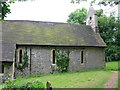
St Michael The Archangel church
Now a private house this was the former parish church of Hawkinge
Image: © Nick Smith
Taken: 13 Jun 2009
0.19 miles