IMAGES TAKEN NEAR TO
Little Roke Road, KENLEY, CR8 5NF
Introduction
This page details the photographs taken nearby to Little Roke Road, CR8 5NF by members of the Geograph project.
The Geograph project started in 2005 with the aim of publishing, organising and preserving representative images for every square kilometre of Great Britain, Ireland and the Isle of Man.

There are currently over 7.5m images from over14,400 individuals and you can help contribute to the project by visiting https://www.geograph.org.uk
Image Map
Images are licensed for reuse under creativecommons.org/licenses/by-sa/2.0
Notes
- Clicking on the map will re-center to the selected point.
- The higher the marker number, the further away the image location is from the centre of the postcode.
Image Listing (37 Images Found)
Images are licensed for reuse under creativecommons.org/licenses/by-sa/2.0
Image
Details
Distance
1
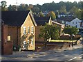
Little Roke Road, Kenley
A view from its junction with the A22. On the left are Grafton House and Lucas House.
Image: © Derek Harper
Taken: 15 Oct 2011
0.04 miles
3
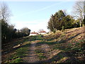
Footpath in School House Wood
This track path leads from the A22 Godstone Road, up through the wood (part of the Riddlesdown to Whyteleafe Countryside Area), leading towards Fennel Walk.
Image: © David Anstiss
Taken: 13 Nov 2011
0.10 miles
4
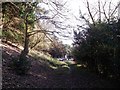
Footpath to Kenley
This track path leads from Fennel Walk down through School House Wood (part of the Riddlesdown to Whyteleafe Countryside Area), leading towards the A22 Godstone Road (in the background).
Image: © David Anstiss
Taken: 13 Nov 2011
0.12 miles
5
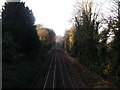
Railway to Purley
This line leads from Oxted (via Warlingham and Whyteleafe) and then Kenley before heading towards Purley and joining the line towards Croydon.
Image: © David Anstiss
Taken: 13 Nov 2011
0.18 miles
6
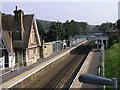
Kenley Station
Kenley Railway station. Notice the boarded up station house.
Image: © Hywel Williams
Taken: 22 Sep 2005
0.19 miles
7
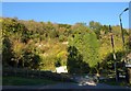
Former chalk pit, Kenley
Unsurprising that the steep slope of Riddlesdown should have been quarried for chalk. The map shows something unexpected here, however: an underground factory, possibly in a wartime shelter that existed at Kenley. I've not discovered any more information about it.
Image: © Derek Harper
Taken: 15 Oct 2011
0.20 miles
8
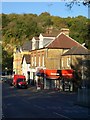
Hayes Road, Kenley
Hayes Road reaches its conclusion passing these shops and meeting the A22 Godstone Road, with Riddlesdown rising steeply beyond.
Image: © Derek Harper
Taken: 15 Oct 2011
0.20 miles
9
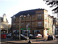
Kenley Co-coperative Supermarket
Small local supermarket on the A22 Godstone Road, near Hayes Lane (on the right). Is part of a development with apartments above.
Image: © David Anstiss
Taken: 13 Nov 2011
0.20 miles