
IMAGES TAKEN NEAR TO
Old Lodge Lane, PURLEY, CR8 4DF
Introduction
This page details the photographs taken nearby to Old Lodge Lane, CR8 4DF by members of the Geograph project.
The Geograph project started in 2005 with the aim of publishing, organising and preserving representative images for every square kilometre of Great Britain, Ireland and the Isle of Man.

There are currently over 7.5m images from over14,400 individuals and you can help contribute to the project by visiting https://www.geograph.org.uk
Image Map
Images are licensed for reuse under creativecommons.org/licenses/by-sa/2.0
Notes
- Clicking on the map will re-center to the selected point.
- The higher the marker number, the further away the image location is from the centre of the postcode.
Image Listing (43 Images Found)
Images are licensed for reuse under creativecommons.org/licenses/by-sa/2.0
Image
Details
Distance
1
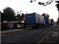
Lorries on Old Lodge Lane
These three tarpaulin covered trucks are removing portable cabins. The cabins were used as site offices, changing room and restroom for the workers building the new Nursery at Beaumont Primary School.
Sunday is a quiet day to remove these large containers to the new site!
Image: © David Anstiss
Taken: 13 Nov 2011
0.02 miles
2
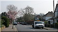
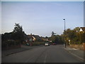
Street Scene in Old Lodge Lane
This end of the road is definitely in the town, but the other end of the road is still quite rural.
Image: © Peter Trimming
Taken: 3 Apr 2009
0.04 miles
3
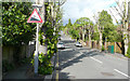
Bencombe Road - Steep Hill 15%
Bencombe Road, Reedham. 15% steep hill down sign, in the wrong place.
Image: © Adam Morse
Taken: 26 May 2009
0.05 miles
4
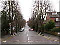
Looking up Bencom(b)e Road
The road name is shown in most maps as Bencombe Road, but the sign on the corner clearly gives it as Bencome.
The 15% gradient sign here and at the top of the hill Image have been put the wrong way round, as the sign warns of a downhill gradient.
Image: © Stephen Craven
Taken: 14 Feb 2013
0.05 miles
5
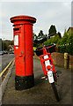
On a Hat-trick
Seen at the lower end of Hartley Old Road, Purley, Surrey. Post box, Postman's bicycle; just missing the Postman. I had seen him near the other end of the road, and would probably have had to wait several minutes to complete the hat-trick.
Image: © Peter Trimming
Taken: 7 Nov 2012
0.08 miles
7
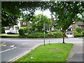
Looking across Old Lodge Lane, Reedham
Reedham took its name from the Reedham Home for Fatherless Children, opened in 1844. This in turn took its name from its founder, philanthropist the Rev. Andrew Reed - see http://en.wikipedia.org/wiki/Andrew_Reed_(clergyman) The Home was renamed Reedham Orphanage in 1904 and Reedham School in 1950. It closed in 1979, but the trust which ran it still occupies the original lodge (gatehouse) of the estate. This is just to the right (out of the picture) on the corner of Old Lodge Lane and Reedham Drive. This photograph was taken from Reedham Drive and looks across Old Lodge Lane.
Image: © Marathon
Taken: 18 Jul 2012
0.11 miles
8
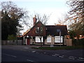
Reedham Orphanage
This building, on the junction of Old Lodge Lane (on the left) and Reedham Drive (on the right) is a built on the site of the Reedham Orphanage that stood here. It is now occupied by the Reedham Trust.
On the wall is a blue plaque which reads "Reedham Orphanage Founded in 1844 by Rev. D. Andrew Reed Stood on this hillside from 1856-1979"
Image: © David Anstiss
Taken: 13 Nov 2011
0.11 miles
9
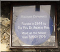
Blue plaque for former Reedham Orphanage
The plaque, behind protective glazing, on the old lodge Image refers to an orphanage (originally the "Asylum for Fatherless Children") that stood "on this hillside" from 1856 to 1979. The site is now a primary school. Its founder was Andrew Reed: is that where the village got its name?
Image: © Stephen Craven
Taken: 14 Feb 2013
0.12 miles
10
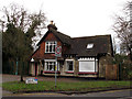
Old building on Old Lodge Lane
I wonder if this is the "lodge" referenced by the road name?
Image: © Stephen Craven
Taken: 14 Feb 2013
0.12 miles