
IMAGES TAKEN NEAR TO
Chipstead Valley Road, COULSDON, CR5 3BN
Introduction
This page details the photographs taken nearby to Chipstead Valley Road, CR5 3BN by members of the Geograph project.
The Geograph project started in 2005 with the aim of publishing, organising and preserving representative images for every square kilometre of Great Britain, Ireland and the Isle of Man.

There are currently over 7.5m images from over14,400 individuals and you can help contribute to the project by visiting https://www.geograph.org.uk
Image Map
Images are licensed for reuse under creativecommons.org/licenses/by-sa/2.0
Notes
- Clicking on the map will re-center to the selected point.
- The higher the marker number, the further away the image location is from the centre of the postcode.
Image Listing (35 Images Found)
Images are licensed for reuse under creativecommons.org/licenses/by-sa/2.0
Image
Details
Distance
1
Chipstead Valley Road
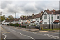
Housing in Chipstead Valley Road. The 1912-3 1:2,500 map shows a few groups of houses in this road, at which time it was called Smithambottom Road. Full development is shown on the 1:2,500 map, including these houses seen here. Most of the road is in Coulsdon in the London Borough of Croydon, but this stretch is in Surrey - maps show the border to run through the middle of the house on the far right of the photo.
Image: © Ian Capper
Taken: 27 Oct 2018
0.02 miles
2
Chipstead Valley Primary School and Nursery
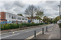
Primary school and nursery in Chipstead Valley Road. Although it is run by the London Borough of Croydon and serves West Coulsdon, it is situated just over the Surrey border.
Image: © Ian Capper
Taken: 27 Oct 2018
0.03 miles
3
Chipstead Valley Road, Woodmansterne
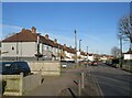
Chipstead Valley Road, on the outer fringe of south London, is on the route of the B2032.
Image: © Malc McDonald
Taken: 19 Feb 2023
0.03 miles
4
Sandown Road, Woodmansterne
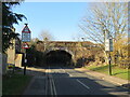
Sandown Road in Woodmansterne, on the outer fringe of south London. Here, the road passes beneath a bridge carrying a railway line before turning sharply to the right.
Image: © Malc McDonald
Taken: 19 Feb 2023
0.04 miles
5
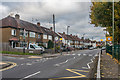
Chipstead Valley Road
Housing in Chipstead Valley Road. The 1912-3 1:2,500 map shows a few groups of houses in this road, at which time it was called Smithambottom Road. Full development is shown on the 1935 1:2,500 map, including these houses seen here.
Image: © Ian Capper
Taken: 27 Oct 2018
0.05 miles
6
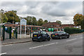
Chipstead Valley Primary School and Nursery
Primary school and nursery in Chipstead Valley Road. Although it is run by the London Borough of Croydon and serves West Coulsdon, it is situated just over the Surrey border.
Image: © Ian Capper
Taken: 27 Oct 2018
0.07 miles
7
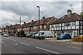
Chipstead Valley Road
Housing in Chipstead Valley Road. The 1912-3 1:2,500 map shows a few groups of houses in this road, at which time it was called Smithambottom Road. Full development is shown on the 1935 1:2,500 map, including these houses seen here.
Image: © Ian Capper
Taken: 27 Oct 2018
0.09 miles
8

Edward VIII postbox, Chipstead Valley Road / Gidd Hill - royal cipher
Image: © Mike Quinn
Taken: 13 Aug 2008
0.11 miles
9
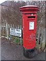
Coulsdon: postbox № CR5 429, Chipstead Valley Road
This Edward VIII-reign postbox stands on the corner of Gidd Hill, as can be seen by the road sign alongside. As he reigned for less than a year and abdicated in frowned-upon circumstances, boxes bearing his cipher are few and far between. There are perhaps just over 100 in present-day use.
Image: © Chris Downer
Taken: 31 Jan 2015
0.11 miles
10
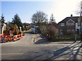
Post Box
CR5 429 Chipstead Valley Road (417) Corner of Gidd Hill
Image: © The Saunterer
Taken: 5 Mar 2013
0.11 miles