Chipstead Valley Road
Introduction
The photograph on this page of Chipstead Valley Road by Ian Capper as part of the Geograph project.
The Geograph project started in 2005 with the aim of publishing, organising and preserving representative images for every square kilometre of Great Britain, Ireland and the Isle of Man.

There are currently over 7.5m images from over 14,400 individuals and you can help contribute to the project by visiting https://www.geograph.org.uk
Chipstead Valley Road
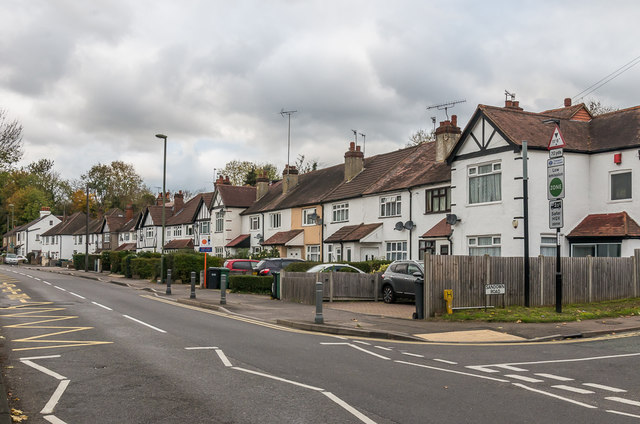
Image: © Ian Capper Taken: 27 Oct 2018
Housing in Chipstead Valley Road. The 1912-3 1:2,500 map shows a few groups of houses in this road, at which time it was called Smithambottom Road. Full development is shown on the 1:2,500 map, including these houses seen here. Most of the road is in Coulsdon in the London Borough of Croydon, but this stretch is in Surrey - maps show the border to run through the middle of the house on the far right of the photo.
Images are licensed for reuse under creativecommons.org/licenses/by-sa/2.0
Image Location
Latitude
51.316896
Longitude
-0.161106