
IMAGES TAKEN NEAR TO
Beechwood Avenue, COULSDON, CR5 2PE
Introduction
This page details the photographs taken nearby to Beechwood Avenue, CR5 2PE by members of the Geograph project.
The Geograph project started in 2005 with the aim of publishing, organising and preserving representative images for every square kilometre of Great Britain, Ireland and the Isle of Man.

There are currently over 7.5m images from over14,400 individuals and you can help contribute to the project by visiting https://www.geograph.org.uk
Image Map
Images are licensed for reuse under creativecommons.org/licenses/by-sa/2.0
Notes
- Clicking on the map will re-center to the selected point.
- The higher the marker number, the further away the image location is from the centre of the postcode.
Image Listing (16 Images Found)
Images are licensed for reuse under creativecommons.org/licenses/by-sa/2.0
Image
Details
Distance
1
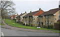
Houses in Beechwood Avenue, Coulsdon
I am not sure whether these houses form part of the Clock House estate or not.
Image: © David Kemp
Taken: 8 Apr 2015
0.03 miles
2
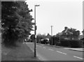
Grove Lane, Coulsdon
On the London Loop path, this is part of a 2km-ish length of roadside walking as the route goes through Coulsdon.
Loop waymark on the lamp post.
Really nondescript this, except that you get a choice of walking on paving or grass depending which side of the road you're on.
Image: © Des Blenkinsopp
Taken: 23 May 2012
0.06 miles
3
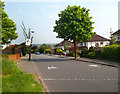
Mark That Boundary
Not content with a notice or the usual change in tarmac colour, the boundary between the London Boroughs of Croydon and Sutton is marked here by a line of stone setts in the road.
That lamp post is skewed that way, it's not my photography. (unlike the houses which lean the other way.....oh well...)
Image: © Des Blenkinsopp
Taken: 23 May 2012
0.15 miles
4
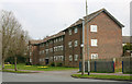
The Mount, Clock House Estate, Coulsdon
The Mount is one of the principal roads on this estate. Though administratively in the London Borough of Sutton, Clock House is separated from it by open country and is virtually part of Coulsdon in the adjoining Borough of Croydon.
Image: © David Kemp
Taken: 8 Apr 2015
0.20 miles
5
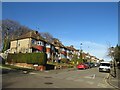
Winifred Road, Coulsdon
Winifred Road is a residential road in Coulsdon, in the outer suburbs of south London. The houses are built on a hillside, thus they stand at a higher level than the road.
Image: © Malc McDonald
Taken: 19 Feb 2023
0.20 miles
6
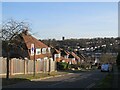
Alexander Road, Coulsdon
Alexander Road is a residential road on a hillside in Coulsdon, in the outer suburbs of south London.
This image was taken on a sunny February afternoon. At this time of year, the sun is low in the sky, resulting in long shadows.
Image: © Malc McDonald
Taken: 19 Feb 2023
0.21 miles
7
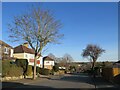
Winter trees on Woodmansterne Road, Coulsdon
Trees on Woodmansterne Road, a residential road in Coulsdon in the outer suburbs of south London.
This image was taken on a February afternoon. Trees were bare for the winter months. The sun was low in the sky, resulting in long shadows.
Image: © Malc McDonald
Taken: 19 Feb 2023
0.21 miles
9
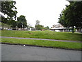
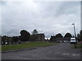
Hillcrest Parade, Woodmansterne
This is a little self-contained community in the middle of nowhere, as far as London goes anyway. It is totally surrounded by green spaces and has only one route in and out at each end.
Image: © David Howard
Taken: 15 Jun 2014
0.22 miles
10
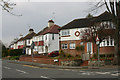
Corner of Woodmansterne Road & Bramley Avenue, Coulsdon
Image: © David Kemp
Taken: 8 Apr 2015
0.23 miles