
IMAGES TAKEN NEAR TO
Breakfield, COULSDON, CR5 2HS
Introduction
This page details the photographs taken nearby to Breakfield, CR5 2HS by members of the Geograph project.
The Geograph project started in 2005 with the aim of publishing, organising and preserving representative images for every square kilometre of Great Britain, Ireland and the Isle of Man.

There are currently over 7.5m images from over14,400 individuals and you can help contribute to the project by visiting https://www.geograph.org.uk
Image Map
Images are licensed for reuse under creativecommons.org/licenses/by-sa/2.0
Notes
- Clicking on the map will re-center to the selected point.
- The higher the marker number, the further away the image location is from the centre of the postcode.
Image Listing (85 Images Found)
Images are licensed for reuse under creativecommons.org/licenses/by-sa/2.0
Image
Details
Distance
1
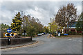
Redlands/Ullswater Crescent
Roundabout where Redlands (in the background) meets Ullswater Crescent. The latter is the access road into the Ullswater Industrial Estate in the former Stoats Nest Quarry, which operated from the early 19th Century until the 1960s.
Image: © Ian Capper
Taken: 27 Oct 2018
0.06 miles
3
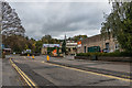
Ullswater Crescent
Access road into the Ullswater Industrial Estate in the former Stoats Nest Quarry, which operated from the early 19th Century until the 1960s.
Image: © Ian Capper
Taken: 27 Oct 2018
0.08 miles
4

Dawn at Marlpit
Dawn at the local park
Image: © Kurseong Carl
Taken: 2 May 2009
0.08 miles
6
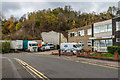
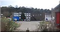
Ullswater Crescent
Access road into the Ullswater Industrial Estate in the former Stoats Nest Quarry, which operated from the early 19th Century until the 1960s, the cliffs of which can be seen in the background of the photo. The building on the right is on the site of the lime kilns of Coulsdon Lime Works which processed the chalk from the quarry.
Image: © Ian Capper
Taken: 27 Oct 2018
0.10 miles
7
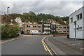
Ullswater Crescent
Access road into the Ullswater Industrial Estate in the former Stoats Nest Quarry, which operated from the early 19th Century until the 1960s, the cliffs of which can be seen in the background of the photo. The building in the middle distance is on the site of the lime kilns of Coulsdon Lime Works which processed the chalk from the quarry.
Image: © Ian Capper
Taken: 27 Oct 2018
0.10 miles
8
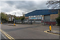
Ullswater Crescent
Access road into the Ullswater Industrial Estate in the former Stoats Nest Quarry, which operated from the early 19th Century until the 1960s.
Image: © Ian Capper
Taken: 27 Oct 2018
0.10 miles
9
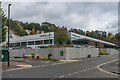
Waitrose.com
Distribution centre for the supermarket Waitrose's internet grocery channel in Ullswater Industrial Estate. The industrial estate is situated in the former Stoats Nest Quarry, which operated from the early 19th Century until the 1960s, the cliffs of which can be seen in the background of the photo.
Image: © Ian Capper
Taken: 27 Oct 2018
0.12 miles
10

Cousdon South station
Coulsdon South station was opened by the South Eastern Railway in October 1889. The line is on a steep gradient climbing towards Merstham Tunnel. It was originally called Coulsdon and Cane Hill, referring to the nearby Cane Hill Hospital - see http://en.wikipedia.org/wiki/Cane_Hill_Hospital Coulsdon South station is on the original Brighton Line, opened in two stages in 1841. To the west is the so-called Quarry Line, built by the London, Brighton & South Coast Railway as an avoiding line between Coulsdon North and Earlswood and which is still used by fast trains avoiding Redhill. It was opened on 8th November 1899.
Image: © Marathon
Taken: 18 Jul 2012
0.13 miles