
IMAGES TAKEN NEAR TO
Belgrave Walk, MITCHAM, CR4 3FU
Introduction
This page details the photographs taken nearby to Belgrave Walk, CR4 3FU by members of the Geograph project.
The Geograph project started in 2005 with the aim of publishing, organising and preserving representative images for every square kilometre of Great Britain, Ireland and the Isle of Man.

There are currently over 7.5m images from over14,400 individuals and you can help contribute to the project by visiting https://www.geograph.org.uk
Image Map
Images are licensed for reuse under creativecommons.org/licenses/by-sa/2.0
Notes
- Clicking on the map will re-center to the selected point.
- The higher the marker number, the further away the image location is from the centre of the postcode.
Image Listing (73 Images Found)
Images are licensed for reuse under creativecommons.org/licenses/by-sa/2.0
Image
Details
Distance
1
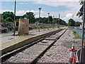
Belgrave Walk Tram Stop - under construction
Image: © Stacey Harris
Taken: 7 Jun 1999
0.04 miles
2
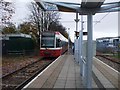
Belgrave Walk tram stop
A New Addington bound tram leaving Belgrave Walk.
Image: © Phillip Perry
Taken: 17 Nov 2008
0.04 miles
3
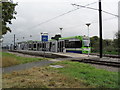
Belgrave Walk
A Bombardier Transportation Flexity Swift CR4000 tram operated by London Tramlink at Belgrave Walk station.
Image: © Burgess Von Thunen
Taken: 13 Oct 2011
0.06 miles
4
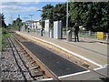
Belgrave Walk tram stop, Greater London
Opened in 2000 by Tramlink on the line from Croydon to Wimbledon.
View north west towards Phipps Bridge and Wimbledon. This was formerly the London Brighton & South Coast railway line, also from Croydon to Wimbledon.
Image: © Nigel Thompson
Taken: 10 Aug 2017
0.06 miles
5
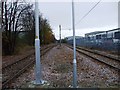
Croydon Tramlink
Looking towards Croydon taken from Belgrave Walk tram stop.
Image: © Phillip Perry
Taken: 17 Nov 2008
0.07 miles
6
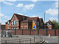
Benedict Primary School, Mitcham
The school, on Benedict Road, opened in 1897 and the original name - Lower Mitcham Board School - can still be seen in the brickwork.
Image: © Stephen Craven
Taken: 10 May 2010
0.10 miles
7
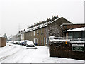
Church Path, Mitcham
The church to which the road name refers is the Anglican parish church Image behind the photographer.
This was taken on the last day of the long Christmas/New Year cold spell and about 5cm of snow had fallen.
Image: © Stephen Craven
Taken: 13 Jan 2010
0.12 miles
8
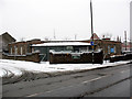
La Sporta, Church Road, Mitcham
A community centre that is apparently also used by the Life Tabernacle church.
Image: © Stephen Craven
Taken: 13 Jan 2010
0.12 miles
9
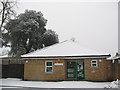
Mitcham Parish Centre
The halls for nearby St Peter & St Paul's (the parish church).
Image: © Stephen Craven
Taken: 13 Jan 2010
0.13 miles
10
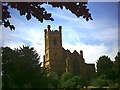
Mitcham Parish Church, Church Road, Mitcham.
St. Peter & St. Paul. As seen from the churchyard to the East of the church.
Image: © Noel Foster
Taken: 19 Jun 2005
0.13 miles