IMAGES TAKEN NEAR TO
Danvers Way, CATERHAM, CR3 5FJ
Introduction
This page details the photographs taken nearby to Danvers Way, CR3 5FJ by members of the Geograph project.
The Geograph project started in 2005 with the aim of publishing, organising and preserving representative images for every square kilometre of Great Britain, Ireland and the Isle of Man.

There are currently over 7.5m images from over14,400 individuals and you can help contribute to the project by visiting https://www.geograph.org.uk
Image Map
Images are licensed for reuse under creativecommons.org/licenses/by-sa/2.0
Notes
- Clicking on the map will re-center to the selected point.
- The higher the marker number, the further away the image location is from the centre of the postcode.
Image Listing (21 Images Found)
Images are licensed for reuse under creativecommons.org/licenses/by-sa/2.0
Image
Details
Distance
1
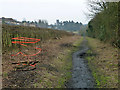
Green Lane, Caterham
A long straight lane with public bridleway status. It must have had heavier traffic in the past, as most of the way it has a more or less disintegrated tarmac surface. Possibly this was to do with the nearby Caterham Barracks, now closed and redeveloped. Recent scrub clearance has revealed a series of manholes with missing or broken covers, one is cordoned on the left.
Image: © Robin Webster
Taken: 1 Feb 2011
0.07 miles
2
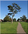
Pine, Hambledon Park
A footpath linking Green Lane to Coulsdon Road passes a pine tree on the belt of parkland, shown further northeast in Image, which has the tree on the left..
Image: © Derek Harper
Taken: 15 Oct 2011
0.13 miles
3
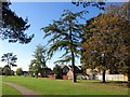
Park, Caterham on the Hill
A belt of parkland between areas of housing at Hambledon Park, and connecting Coulsdon Road to Green Lane.
Image: © Derek Harper
Taken: 15 Oct 2011
0.15 miles
4
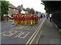
Caterham Carnival Parade
Disappointingly, this parade was not headed up by a brass band, (which used to be considered de rigueur on such occasions). However, further back there was a King Billy style fife and drum outfit.
Image: © Dr Neil Clifton
Taken: 13 Jun 2009
0.17 miles
5
Yorke Gate, Caterham
From the junction with Coulsdon Road
Image: © Dr Neil Clifton
Taken: 13 Jun 2009
0.18 miles
6
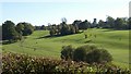
Surrey National Golf Club
This course opened in 1999; this northern area occupies a dry valley in the North Downs. For those following bridleway 77, it is designed so that no fairway is crossed, an advantage not shared by most older courses.
Image: © Derek Harper
Taken: 15 Oct 2011
0.19 miles
7
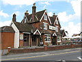
The Village Inn, Caterham
This public house was formerly called the Caterham Arms, and it was a place of resort for soldiers based in the nearby Coldstream Guards barracks. On 28 September 1973, the IRA detonated a device in the pub, with the intention of killing British soldiers, but fortunately all present escaped with their lives.
Image: © Dr Neil Clifton
Taken: 13 Jun 2009
0.19 miles
8
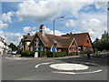
Caterham Community Church
External notices do not reveal to which of the many branches of Christianity this church is attached to. However, I am indebted to Mr Tony Watson for the following information, which I quote in verbatim:
"This church was formerly Caterham Hill Congregational Church and still retains its legal affiliation to the Congregational Federation (the rump of Congregational churches that did not join the Presbyterians in the United Reformed Church). However, its worship style is more contemporary than is generally the case in the Congregational Church, hence its conscious decision not to advertise its affiliation."
Image: © Dr Neil Clifton
Taken: 13 Jun 2009
0.20 miles