IMAGES TAKEN NEAR TO
Borrowdale Drive, SOUTH CROYDON, CR2 9JS
Introduction
This page details the photographs taken nearby to Borrowdale Drive, CR2 9JS by members of the Geograph project.
The Geograph project started in 2005 with the aim of publishing, organising and preserving representative images for every square kilometre of Great Britain, Ireland and the Isle of Man.

There are currently over 7.5m images from over14,400 individuals and you can help contribute to the project by visiting https://www.geograph.org.uk
Image Map
Images are licensed for reuse under creativecommons.org/licenses/by-sa/2.0
Notes
- Clicking on the map will re-center to the selected point.
- The higher the marker number, the further away the image location is from the centre of the postcode.
Image Listing (33 Images Found)
Images are licensed for reuse under creativecommons.org/licenses/by-sa/2.0
Image
Details
Distance
1
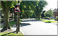
Rectory Park - Steep Hill 12%
Rectory Park, Sanderstead. 12% steep hill down sign.
Image: © Adam Morse
Taken: 11 Jun 2009
0.07 miles
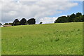
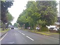
4
Rectory Park, Sanderstead
An attractive sweeping line of horse chestnut trees. Mostly with white flowers, but a couple further down have pretty pink ones. The other side of the road is lined with houses, so they have good views of Mitchley Wood ahead. The area to the left appears to be farmed.
Image: © Stephen Richards
Taken: Unknown
0.15 miles
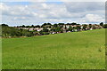
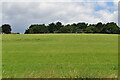
6
View over Mitchley Wood from Rectory Park
Image: © David Howard
Taken: 29 Oct 2012
0.16 miles
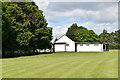
7
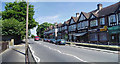
Sanderstead shops
A sedate row of shops at Sanderstead 'village' 12 miles from the city of London on the north downs.
Image: © Nigel Freeman
Taken: 19 Jun 2005
0.17 miles
9
Rectory Park
The view along the A2022 in Sanderstead, Croydon.
Image: © Gordon Griffiths
Taken: 25 May 2018
0.17 miles
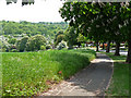
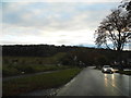
10
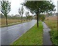
Mitchley Hill
This is looking along the bottom of Mitchley Hill with Mitchley Wood to the left. To the south beyond Mitchley Wood the Green Belt stretches down to Whyteleafe. This was a thoroughly wet and miserable Sunday afternoon.
Image: © Marathon
Taken: 21 Oct 2012
0.18 miles