
IMAGES TAKEN NEAR TO
Mitchley Avenue, SOUTH CROYDON, CR2 9HL
Introduction
This page details the photographs taken nearby to Mitchley Avenue, CR2 9HL by members of the Geograph project.
The Geograph project started in 2005 with the aim of publishing, organising and preserving representative images for every square kilometre of Great Britain, Ireland and the Isle of Man.

There are currently over 7.5m images from over14,400 individuals and you can help contribute to the project by visiting https://www.geograph.org.uk
Image Map
Images are licensed for reuse under creativecommons.org/licenses/by-sa/2.0
Notes
- Clicking on the map will re-center to the selected point.
- The higher the marker number, the further away the image location is from the centre of the postcode.
Image Listing (26 Images Found)
Images are licensed for reuse under creativecommons.org/licenses/by-sa/2.0
Image
Details
Distance
1
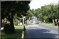
Mitchley Avenue, Sanderstead (6)
Looking westward from the junction with Copthorne Rise, Mitchley Avenue (the A2022) dips and then rises again to where it becomes Downs Court Road and starts the steep descent to Purley.
Image: © Dr Neil Clifton
Taken: 3 Aug 2007
0.02 miles
2
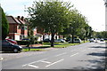
Mitchley Avenue, Sanderstead (7)
Looking eastwards along this road, which is the A2022, the first house visible on the north side is No 89 and the odd numbers ascend from there. There are no buildings on the south side, so these houses have a very pleasant open outlook.
Image: © Dr Neil Clifton
Taken: 3 Aug 2007
0.04 miles
3
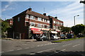
Mitchley Avenue, Sanderstead (4)
Looking east. This small parade of shops lies just west of No 85 on the north side. From the near end, they are: a newsagents and general shop: a glass and mirror shop: a small cafe: and then, of course, all the rest of the frontage is taken up by an estate agent. The road leading off just before the shops is Copthorne Rise.
Image: © Dr Neil Clifton
Taken: 3 Aug 2007
0.04 miles
4

St Edmund, Mitchley Avenue, Riddlesdown - Chancel
Image: © John Salmon
Taken: 25 May 2010
0.04 miles
5
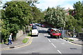
Looking up Copthorne Rise, Sanderstead
Copthorne Rise runs northward off Mitchley Avenue, just west of the small shopping parade.
Image: © Dr Neil Clifton
Taken: 3 Aug 2007
0.05 miles
6
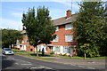
Mitchley Avenue, Sanderstead (5)
On the north side, just west of Copthorne Avenue, are these two small blocks of flats.
Image: © Dr Neil Clifton
Taken: 3 Aug 2007
0.05 miles
7
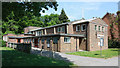
St Edmund, Mitchley Avenue, Riddlesdown
Image: © John Salmon
Taken: 25 May 2010
0.05 miles
8
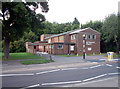
St Edmund's Church, Riddlesdown CR2
In A2022 Mitchley Avenue. Built 1955.
Image: © Philip Talmage
Taken: 4 Sep 2005
0.05 miles
9
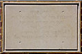
St Edmund, Mitchley Avenue, Riddlesdown - Foundation stone
Image: © John Salmon
Taken: 25 May 2010
0.05 miles
10
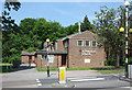
St Edmund, Mitchley Avenue, Riddlesdown
Image: © John Salmon
Taken: 25 May 2010
0.05 miles