IMAGES TAKEN NEAR TO
Hartland Way, CROYDON, CR0 8RJ
Introduction
This page details the photographs taken nearby to Hartland Way, CR0 8RJ by members of the Geograph project.
The Geograph project started in 2005 with the aim of publishing, organising and preserving representative images for every square kilometre of Great Britain, Ireland and the Isle of Man.

There are currently over 7.5m images from over14,400 individuals and you can help contribute to the project by visiting https://www.geograph.org.uk
Image Map
Images are licensed for reuse under creativecommons.org/licenses/by-sa/2.0
Notes
- Clicking on the map will re-center to the selected point.
- The higher the marker number, the further away the image location is from the centre of the postcode.
Image Listing (67 Images Found)
Images are licensed for reuse under creativecommons.org/licenses/by-sa/2.0
Image
Details
Distance
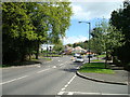
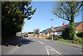
2
Recreation Ground in Shirley
What the low res picture does not show is that the most prominent skyline feature around here is
Image It was prominent in the gap in the trees between the two houses on the right.
Image: © Glyn Baker
Taken: 31 Aug 2016
0.05 miles
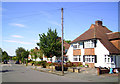
4
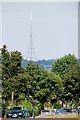
Crystal Palace Transmitter
Looking across the Image towards the gate at the end of Spring Park Avenue, one can see how the TV transmitter dominates the skyline around here.
Image: © Glyn Baker
Taken: 31 Aug 2016
0.08 miles
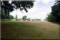
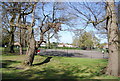
5
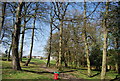
Shirley Church Recreation Ground
A local recreation ground which was purchased in 1928 by the Council to preserve an area of open space among the suburban estates which were rapidly developing. The trees along Shirley Church Road are clearly marked on a map dated 1868 which suggests that the area was well wooded in previous years.
Image: © N Chadwick
Taken: 9 Apr 2011
0.11 miles
6
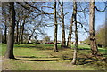
Woodland, Shirley Church Recreation Ground
A local recreation ground which was purchased in 1928 by the Council to preserve an area of open space among the suburban estates which were rapidly developing. The trees along Shirley Church Road are clearly marked on a map dated 1868 which suggests that the area was well wooded in previous years.
Image: © N Chadwick
Taken: 9 Apr 2011
0.13 miles
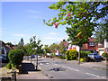
7
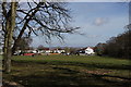
Shirley
Looking across the recreation ground, with buildings in the City of London just visible in the distance.
Image: © Peter Trimming
Taken: 4 Apr 2020
0.13 miles
9
Tennis Courts, Shirley Church Recreation Ground
A local recreation ground which was purchased in 1928 by the Council to preserve an area of open space among the suburban estates which were rapidly developing. The trees along Shirley Church Road are clearly marked on a map dated 1868 which suggests that the area was well wooded in previous years.
Image: © N Chadwick
Taken: 9 Apr 2011
0.14 miles